
It was the home of Zeus and Co in ancient Greek mythology, but these days you're more likely to find walkers and climbers on the country's highest peak. For mountaineers in search of a novel adventure Olympus is ideal, says Robert Wragge-Morley. It looks pretty impressive too.
Several years ago, I discovered that Mt. Olympus in northern Greece not only looked like a stunning mountain but lay very close to the sea, the usual base for climbing it being the town of Litochoro about 3km from the coast. This almost instantly spawned the idea of going from sea to summit – no small undertaking on a mountain that stands some 2918m high. Several abortive attempts were made at travelling there for trips as short as a long weekend to try this, and eventually after much gear faff, some airports and little sleep my friend Tom and I arrived in the deserted out of season seaside resort of Plaka Litochoro on a Friday evening in early April this year.

© Robert Wragge-Morley
Saturday morning dawned clear and fine and at a little bit after 0820h we set off from the seaside verandah at the bottom of the campsite, pounding up the main road to Litochoro in our heavy mountaineering boots, already baking in the Mediterranean sun that beat down on the olive groves and isolated houses and workshops to either side of the road. From the town we were already looking down at the sea behind us, but the snow capped summits of Olympus appeared no closer ahead.
Litochoro lies at the entrance to the Enipea Canyon, a gorge about 8km long that leads up to a valley head below the main summits of Olympus. Down its length tumbles a steeply descending river, whose waters form beautifully clear pools, lightly tinted blue. The less rocky sides of the canyon are covered by beech woods and forests of larch, spruce and cedar, clinging on to the hillsides, whilst the steeper parts form sheer walls of variously tinted limestone, often many hundreds of metres high and punctuated by dramatic pinnacles and vast hanging caves. The path cannot follow the river because the terrain is often too steep, so it winds its way up and down the shallower southern flanks of the canyon, occasionally descending to the river and crossing timber bridges to the northern bank for a short time. In this way, an extra 750 to 800 metres of ascent (and corresponding descent) is added to the route between Litochoro and Prionia, where the tourist road up the valley ends. At the roadhead there is little sense that one is in meditterranean Greece, as steep fir tree clad mountainsides give way to the snows and the cloud base hangs in the trees, concealing the high peaks towering overhead.

© Robert Wragge-Morley
Our goal for this day was Refuge 'A' at about 2100m, which at this time of year would be closed, but should provide a suitable base for us to make the ascent. It is just 3km up the E4 European long distance route (that we had been following all day) from Prionia, but 1000m of altitude separates them. As we toiled higher through the forest, we could just make out the refuge perched atop a rocky outcrop in the forest, and just in to the base of the clouds.
We set up the tent on the hut platform and ate and melted several litres of water from the snow. As the sun sank behind the mountain, the temperature dropped dramatically and the clouds cleared. The twinkling lights of Litochoro seemed very distant and the sea and sky seemed to merge together in a blue haze.
"The architecture of this mountain was on a far bigger scale than we had imagined"
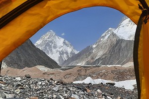
That night was very cold, but gave way to clear blue skies in the morning and with much lighter packs we set out, climbing at first through the woods before finding a way to cross the steep gully separating us from Chonderomesorachi, the ridge leading up to Skala and Skolio. At this time of the year, the snow has already melted from the south side of this ridge, exposing grey limestone scree, but mostly we walked on snow, up away from the trees. To the south, a group of snowy, remote 2500m+ mountains, and ahead a heavily corniced ridge carrying us North towards Skala and Skolio which between them form the second highest of the three major summits. The highest, Mytikas lies just to their north and the third highest, Stefani the 'Throne of Zeus' to the north of that.
Still occasionally passing waymarks for the E4 long distance path, the ascent seemed to take far longer than its 2km and 800m suggested, and as we trudged ever higher, through every type of snow, the cloud we'd been watching on the hills over our shoulders started to creep up upon Mytikas and Skolio.

© Robert Wragge-Morley |

© Robert Wragge-Morley |
Having gained Skala, we could have easily walked to the summit of Skolio about 150m to the West, but instead turned North and began the far more technical descent to the Saddle separating us from Mytikas. At this point a couple of things became apparent; the architecture of this mountain was on a far bigger scale than either of us had imagined, and we were racing an unknown force in the weather. The clouds brought warmer air that softened the snow and then snow as they lifted. This went in cycles. From the col, the sense of scale and grandeur of these mountains is again heightened as the dramatic, steep, North face of Skala comes in to view, and the South Flank of Mytikas looms up ahead.
From this direction the ascent of Mytikas is quite technical and under snow truly alpine in flavour, but that is why we'd come. It is an engrossing exercise in the very exposed and comes recommended to those with a bit of alpine know-how. The summer variation, clear of snow is meant to be rather less technically demanding but I should think it would still be pretty scary in places. The 'normal' route on the mountain is to approach via a couloir (rocky in summer, snowy in winter) accessed from an area of steep ground below the peaks known as the Zonaria, to use this route it is probably most sensible to stay at or near the refuges on the Muses Plateau to the North of the main peaks.
We lost a lot of time crossing three descending guided teams at the same place. After meeting them we continued a little higher, but became increasingly worried about time and snow conditions. So we boldly turned tail and fled. From sub-Mytikas, an airy pinacle about 20 vertical metres shy of the true top of Greece, we descended soggy, dubious snow interspersed with awkward rocky steps, using the occasional fixed gear or dodgy axe-belay where our 30m of rope would not carry us to the next rock.

© Robert Wragge-Morley
Safely back on top of Skala we quickly unroped, and eating on the move began descending the way we had come. The snow was much softer now, both melting and being covered by a new layer during the day, meaning we sank deeply or slipped sideways where we hadn't done on the ascent. The mountains all around were no less magnificent, but we had learned new respect for them. The craggy peaks of Olympus are very much alpine in scale and deserve the same kind of treatment.
After the gully crossing, a final short descent through beautifully atmospheric cedar forest brought us back to the hut platform at about 1930h, twelve hours after we left that morning and with about half an hour of daylight left, longer than our enormous walk in. Wearily we ate lunch and dinner in one sitting and put ourselves to bed. We had come a very long way from the sea to within a few metres of the highest point in Greece, before being driven down by the weather and lost time.
We started a little later on the Monday morning, having made a decision the night before not to cross to the far side of the gorge to descend, but instead to go via the beautiful Enipea canyon, revisiting the holy spring of St. Dionysus and marvelling once again at the sheer scale and beauty, and loneliness of this place. The descent was long and warm and humid, with occasional outbreaks of rain, and quite long periods of ascent as we wove our way down out of the canyon and back into Litochoro, where we ate, filled our water and resupplied whilst the cloud finally lifted off the mountain and allowed us to see where we had been.
The final hour or so back to the sea passed quite quickly, we were barely aware of the guard dogs, though on the descent of the canyon we noticed many things that we had been too exhausted and working too hard to see on our way up.
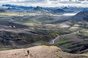
Over the three days we covered about 45km, 3600m of ascent and descent in terrain varying from woodland trails to alpine ridges. The entire journey held constant interest, either through the flora and fauna or the technicality, and always through the sheer beauty of the place.

© Robert Wragge-Morley
When to go
Spring or Autumn are probably best depending on your feelings towards snow, there is snow lying in the mountains from November until April, but on Olympus patches may persist until June. In high summer, temperatures can reach 25C at 2000m and lower down in the valleys far hotter than that. In the summer hundreds of people climb Olympus, but when there is snow lying very few people visit the mountain. Elsewhere in Greece the mountains are seldom visited at any time of year, but they are both extensive and beautiful.
Getting there and around
For Olympus and the Pindos Mountains, the nearest airport is Thessaloniki. Both Easyjet and Rynair fly there, as well as other budget airlines, and provided you book a reasonable time in advance they shouldn't be too expensive.
To reach Litochoro, there is a KTEL (national provider) bus service that takes about an hour from Thessaloniki, there are shuttles between the airport and the bus station, but if you want to explore the other mountain areas it is advisable to hire a car since the remote mountain villages are not well connected (or indeed connected at all) by public transport. The car also served as a convenient place to leave things when we were on the hill.
In the towns near Olympus there are plenty of English speakers who can be helpful, but venture deeper into the mountains and foreign visitors are very rare indeed, and it is safe to assume you won't meet anyone who speaks English, especially outside the more significant towns. It's also worth knowing how the Greek alphabet is pronounces so you can understand place names.
Food, accommodation and costs
In the larger villages and towns there are food shops, that may or may not be 'supermarkets' – Litochoro and Plaka Litochoro both have them.
On the hill we used a petrol stove for evening meals and melting snow, it is much easier to buy petrol than gas and the pump attendants don't seem to mind putting 1euro's worth in a fuel bottle.
You can eat out fairly cheaply, 9 Euros will buy a properly nice meal (starter and main) in a restaurant, and in the spring there are a few open even on the coast, Litochoro and other tourist towns have plenty of restaurants and tabernas (restaurant-bars).
By the coast, we stayed at either end of our Olympus trip in a camping-chalet on a nearly deserted beach resort (it was the only one open in April) which was 30 euros and provided a good base to organise ourselves from. There are hotels and smaller guest houses available in the tourist towns.
On Olympus there are a number of refuges. These cost 12 euros a night during the season when they are open. Camping is not permitted in national parks (of which Olympus is one) but this rule is relaxed in the high mountains and if you wish to camp near the refuges there is a small charge.
We did an 8 day trip visiting Olympus and the mountains around Elati Trikalon for just over £500 each including flights, accommodation, car hire, fuel for about 1000km of driving and food.
What gear to take
In the spring, certainly through April and later on the highest mountains, go equipped for Scottish winter hillwalking and you can't go far wrong – as long as you're prepared to carry most of it when you're lower down – for the valley approaches, be prepared for it to be hot even early in the season. If you're planning on sleeping at altitude be prepared for the temperatures to be well below freezing at night, probably below -5C at 2000m, though I didn't check (as ever this is dependent on cloud and weather). Once the snow has gone go as light as possible without compromising yourself – plenty of food and water and although the weather is more stable than in the British hills, be prepared for sudden storms and general mountain fickleness.
Maps, guidebooks and useful websites
Anavasi produce a good range of maps covering most mountain areas at 1:50000 and a few (like Olympus) at 1:25000, the maps are printed on plastic and are modern and clear (about halfway between OS and Harvey in style). They are available from Stanfords, or electronically direct from the cartographer .
There is a Cicerone Guidebook, The Mountains of Greece by Tim Salmon, which covers a very large area as a South to North Traverse of the Pindos range, and includes walking routes for elsewhere in the country. The routes are described in summer conditions, including a huge horse-shoe circuit of Olympus. This book has lots of good general information.
For detailed GPS routes throughout the country, there is the routes database on Hellaspath, which is effectively the Greek version of UKH. This is only available in Greek, but can be navigated around using a map to access the mountains and areas, and google translate is your friend.
With some translation, Olympus-climbing.gr is also a useful resource about the mountain and routes on it, as well as having a complete list of refuges and huts on the mountain. This website is run by the custodian of the Kakkalos Refuge 'C'
There is also some information on the website Summitpost, though the coverage is fairly patchy.
http://www.hnms.gr/hnms/english/index_html is the government weather forecasting office.
For Olympus conditions, I spent a lot of time watching this webcam – the view is generally clearest and most cloud free in the early mornings and in the evening, clouds build up during the day: http://www.pc-blaulicht.de/olymp.htm


Comments