

The European Space Agency has given financial backing to a new project which aims to map tick hot spots in the Scottish Highlands using GPS technology, smartphones and 'citizen scientists'.

The ESA has awarded €250,000 to a consortium including NHS Highland, the University of the Highlands and Islands and Scotland's Rural College, to test the feasibility of LymeMap, a phone app and web-based system that will enlist the help of the outdoor-going public to track the blood-sucking disease-bearing parasites.
LymeMap aims to provide information and advice on ticks and Lyme disease to members of the public, people who work outdoors, healthcare professionals and other organisations.
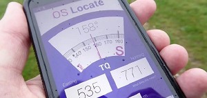
The system will use GPS technology to provide information on a user’s location, including data such as the altitude, temperature and ground cover. Individuals can upload information on ticks through the app, and this – together with data from GPs and NHS Highland’s National Lyme Borreliosis Testing Laboratory at Raigmore Hospital, Inverness – will be used to produce maps showing where they are most prevalent.
'Lyme disease is the most common vector-borne human disease in the UK, and the number of cases reported in Scotland has increased ten-fold in the past 10 years' said Roger Evans, a clinical scientist with NHS Highland.
Climbers and walkers are among those most at risk of Lyme disease. Yet the infection is still misunderstood by many healthcare professionals, making a correct and timely diagnosis a bit of a lottery.
'If it is not diagnosed and treated properly, it can lead to a severe and debilitating disease' said Evans.
 © Dr Keith Ryan, Dartmoor Tick Watch
'Unfortunately, health organisations have limited effective tools at their disposal to reduce the incidence of Lyme disease. Resident and visiting populations need an approach that will help them prevent getting Lyme disease and manage exposure to ticks. From a health and safety and an economic point of view, organisations and businesses that employ people exposed to infected ticks also need a better tool for preventing the disease.'
'We believe that by using the latest technology and what’s commonly called citizen science we can create an interactive and accurate Lyme disease identification and risk management system.'
The next step is a one-year study to test the technical and commercial feasibility of LymeMap. Provided this is a success, and of course subject to funding, the project is expected to move to a demonstrator phase before being commercialised.
There is also talk of extending the system to other diseases that can be passed between animals and humans, as well as to other countries - again funds permitting.
The European Space Agency funding follows work facilitated by the Centre of Health Science to try to establish the true incidence of the disease in the Highlands and to look at new ways of tackling it.


Comments