


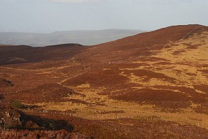
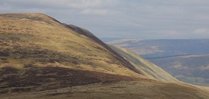
Rhinog Fach has been added to the list of Marilyns, following a re-survey of its relative prominence. The peak, arguably the most impressive in the Rhinogydd, is a major addition to the list of (now) 1556 summits.

© allenp
A Marilyn is any hill in Britain that has a minimum drop of 150m, irrespective of its overall height. Authored by Alan Dawson, the list was originally published by Cicerone Press in 1992 in the book The Relative Hills of Britain, and has become a popular objective for ambitious baggers.
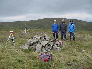
Avid hill surveyor Myrddyn Phillips established Rhinog Fach's Marilyn status on Friday 27th August, having established the height of the summit and the col below, and announced the finding in his blog Mapping Mountains.
"Rhinog Fach has been on the prioritised survey list for a number of years as Alan Dawson had listed it as a high prominence Submarilyn with an estimated c 147m of drop in his Hewitts and Marilyns of Wales booklet published by TACit Tables" says Myrddyn.
"I had an email exchange with Alan about surveying this hill soon after getting my Trimble [survey equipment] in late 2013 and I then promised to survey it as soon as possible. It's only taken me another eight years to do so!"
As Marilyn status depends on a minimum 150m of drop, and as drop is dependent upon the summit and connecting col height, both summit and col needed to be surveyed.
"I operate a piece of equipment named the Trimble GeoXH 6000, this gives highly accurate height and positional data" explains Myrddyn.

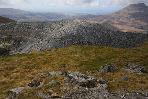
© Myrddyn Phillips

© Myrddyn Phillips
"The Trimble operates in a similar way to a SatNav and gathers signals from orbiting satellites. Once gathered, the resulting data is processed against Rinex Data available via the Ordnance Survey website.
"For Rhinog Fach determining the very highest point of the hill was easy as it consists of a protruding rock positioned about 2 metres from the base of the summit cairn. As the Trimble has an internal antenna it can gather data aligned to the high point without the need for a pole, tripod and external antenna.
"I took two data sets at the summit, one with the Trimble positioned aligned with the high point and one with the Trimble placed on my rucksack which acts as an improvised tripod, with the measurement offset duly noted. This would give comparison of height; in this instance just 0.01m difference.
"Three data sets were taken from the area of the connecting col, the 1st and 2nd on the hill to hill traverse (low point of these signifies the important data set) and the 3rd on the valley to valley traverse. The high point of the 3rd compared to the important one of the 1st and the 2nd surveys signifies the all-important col position. This can get a little complicated on occasion, and when conditions are extremely warm and a multitude of surveys are being taken it even baffles me sometimes!"

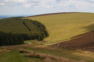
© Myfyr Tomos, Oct 2018
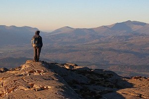
As one of the more impressive peaks in Wales, Rhinog Fach counts as a major addition to the Marilyns. But thanks to their prominence, even less distinctive entries on the list have their attractions, according to Myrddyn:
"One of the joys of the Marilyns is the variety of hills included in the list" he says, "with many of the giants as well as many lower heighted hills qualifying. All of them are relatively prominent and therefore all should, on a good clear day, give extensive views. The last new Welsh Marilyn, Mynydd Anelog (SH 151 272), is only 191.4m high but is positioned toward the end of Pen Llŷn giving beautiful coastal views out toward another Marilyn on Ynys Enlli."
Alan Dawson has now confirmed Rhinog Fach as a new Marilyn, the first in Wales since the survey of Mynydd Anelog in July 2013, and the first in Britain since the survey of Beinn Dearg by Jon Metcalf in 2018.
There's still a slim chance that new entries to the list will be uncovered, Dawson thinks:
"Rhinog Fach has been in need of a survey for many years and it is great news that Myrddyn has done it and made this discovery" he told us.
"The only other realistic possibility for a new Marilyn is Faan Hill on Shetland Mainland, a mere 173m high. That will not be an easy one to survey. Meall an t-Suidhe next to Ben Nevis is estimated to have 147m drop and so it also has a small chance of reaching 150m. There is also the possibility of summits being relocated, as happened recently when Lidar data showed that White Hill near Dumfries was higher than nearby Hightown Hill, though OS maps show it to be a metre lower."


Comments