

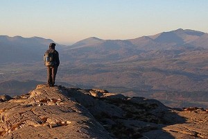
Located in the Radnor Forest in the Mid Wales borderlands, Bache Hill has long been subject to doubt as to its status as a mountain. On OS maps its 610m high point is very close to the agreed mountain height threshold of 2000ft (609.6m), but the trig point stands on an ancient burial mound. Did this man-made structure give Bache Hill an undeserved boost over the line? Hill surveyors Aled Williams and Myrddyn Phillips thought it was high time to settle the question.
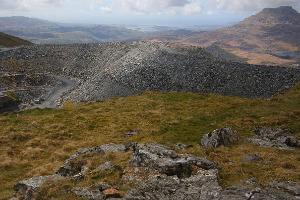
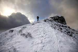
Bache Hill is rather unassuming, positioned close to border country in eastern mid Wales with a large conifer plantation to its north and reclaimed grazing land to its south. The hill's one redeeming feature is its impressive summit tumulus, which at 3m in height and 20 metres in diameter is one of the finest of its kind in this part of Wales. This was built in the Bronze Age approximately 5,000 years ago and stands aloof overlooking this hill's heathery summit plateau. But is it the hill's true high point?

© Myrddyn Phillips
Bache Hill has a 610m summit spot height on contemporary Ordnance Survey maps. This is given to a triangulation pillar that has a 610.209m flush bracket height which is positioned approximately 0.35m above the base of the trig pillar. Therefore, the ground at its base will be around 609.859m. This is only 0.26m above the benchmark height of 2,000ft (609.6m). However, the trig pillar is positioned on top of the ancient tumulus.
Therefore, the base of the tumulus is about 607m in height; in relative terms this is quite a bit lower than the 609.6m (2,000ft) benchmark height required for Hewitt (2,000ft P30) and Nuttall (2,000ft P15) status. Although impressive it's been thought that the tumulus could be this hill's downfall, as it is man-made, and some hill list authors and hill baggers discount such a construct from being included as a part of the hill's height - and especially so if the natural summit is intact and not buried under the tumulus.
However, I'd visited this hill on 21 previous occasions and although not having stood on its summit for 16 years, I remembered looking west from the top of the tumulus to a bed of heather and wondering if in fact the natural summit of the hill still existed, since the ground thereabouts looked as if it might be higher.
Was the natural summit of this hill in fact to the west of the questionable tumulus, and if so was it sufficiently high to break through the 2,000ft (609.6m) barrier?

© Myrddyn Phillips
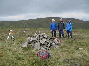
To answer the questions a Trimble GeoXH 6000 was used to survey various points surrounding the tumulus, at its top and also to its north-west and west. The Trimble gives highly accurate height and positional data and has proven an essential bit of kit in various surveying expeditions over recent years. The survey was conducted with Aled Williams who suggested the walk, and we both realised the ramifications of what we planned to do.
These ramifications had all sorts of potential conclusions: the natural summit may be under the tumulus; it could still exist; if so where was it; was it above or less than 2,000ft in height; could it even be higher than the top of the tumulus?
Bache Hill might no longer be accepted in the Hewitt or Nuttall listings if the natural summit was below 2,000ft, or conversely it might remain even if the natural summit existed and was below this height, as long as the tumulus was over 2,000ft (609.6m). It was all rather mind boggling, especially when there are those that would discount the height of the tumulus in preference to the natural summit if the latter was proven to exist, even if lower than the tumulus.
So many questions to answer and only one way to find out; survey the hill.
- We gathered four data sets from the base of the tumulus, each 45° from one another. This would give a good spread of height and indicate where the higher and lower ground met the tumulus.
- One data set was gathered from the high point of the tumulus which is about one metre from the base of the trig pillar.
- A further data set was gathered just to the north-west of the tumulus on rising ground.
- And a further two data sets were gathered westward of the tumulus about 100 metres from it. It was here that we considered the natural summit of the hill to be positioned.

© Myrddyn Phillips
And what of the results? Take a deep breath…
Base of tumulus:
- 1st survey: 607.869m at SO 21377 63648
- 2nd survey: 607.608m at SO 21392 63653
- 3rd survey: 607.024m at SO 21397 63642
- 4th survey: 607.278m at SO 21382 63635
Although the base of the tumulus undulates, the position of the first survey indicates ground on its western side is the highest and ground on its eastern side the lowest. This confirms what we thought when standing beside the trig pillar as ground to our east gradually descended, whereas ground to our west definitely went uphill.
Top of tumulus:
- 5th survey: 610.121m at SO 21386 63643
To the north-west of Tumulus:
- 6th survey: 608.416m at SO 21353 63662
100 metres to west of Tumulus:
- 7th survey: 610.094m at SO 21281 63610
- 8th survey: 609.904m at SO 21271 63605
Conclusion:
The 7th and 8th surveys complement each other and confirm the natural summit of this hill is intact and is at, or in the vicinity of, grid reference SO 21281 63610.
The measurement offset for the 7th and 8th surveys was taken down to the base of the heather in the peat. However, you could easily go down a few more centimetres if so inclined, but you would have to go down a further 0.487m (about 1½ft) for this part of the hill to be below 609.6m. This confirms the natural summit is over 2,000ft (609.6m) in height.
Lastly, the Trimble result gives the 7th survey as only 0.027m below the high point of the tumulus. That a natural summit exists, and its position west of the tumulus was not a surprise, but its height being so close to that of the tumulus was.
Bache Hill can again rest in the knowledge that it retains its 2,000ft status, both to its ancient tumulus and now also confirmed to its natural summit.


Comments