West Lomond, Fife Walking

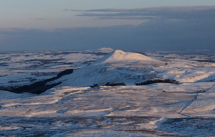
Fife's Lomond Hills have nothing to do with the better known loch and Munro of the same name. They form a compact little group rising in a mass out of the rolling farmland east of Loch Leven, with steep rocky escarpments and two distinctive domed summits that can be seen from as far afield as Edinburgh and the Cairngorms (on a clear day). These tops have gained the well-earned nickname the Paps of Fife. Given their prominence surrounded by low ground the summit views are predictably wide ranging. This short circuit on the Lomonds' bigger Pap takes in some interesting geology in the mini ravine of Glen Vale and the freaky rock mushroom of the Bunnet Stane.

East Lomond from West Lomond  © Dan Bailey - UKHillwalking.com
East Lomond from West Lomond
Fetching Map

Detailed description

1
NO1730406989 Follow the narrow road southwest, then turn left onto a woodland footpath signed for Glen Vale. The path soon crosses a footbridge, leaving the woods to follow the Glen Burn upstream through open ground. Enter steep-sided Glen Vale, passing beneath the sandstone outcrop of John Knox's Pulpit where secret sermons were held during times of religious intolerance (worse even than today). The path stays left of the gorge with its pretty little waterfall, reaching the wide heather-covered glen above.

2
NO1949705611 Where the trail meets a broader track turn left onto a vague (and easily misplaced) path north-ish up tussocky slopes. Follow the lay of the land bearing a little left along a slight ridge, then onto a broad shoulder just west of West Lomond's summit dome. Cross a low wall, cutting east to pick up a well-trodden path on a last steep pull to the summit cairn and trig point.

3
NO1969506598 In descent retrace the final ascent path, this time staying with it as it starts to curve rightwards around the base of the summit dome. Here cut off north towards the edge of the escarpment. This is descended on a rough and hard-to-spot path, firstly west down a shallow grassy scoop in the slope to pass beneath crumbly rocks. As the slope eases the path follows a fence line before slanting across a field to the sandstone pinnacle of the Bunnet Stane - you can't miss it. There's a carved chamber in the base of the rocks, the Maiden Bower. From here go north-northwest-ish along field boundaries to rejoin the minor road.

4
NO1849208191 Stroll along the road back to the car park.

This has been viewed 12,196 times


Further Routes

by Dan Bailey UKH


Loading Notifications...
Facebook Twitter Copy Email