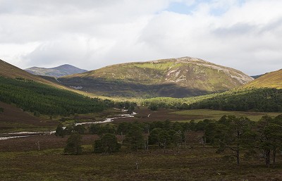
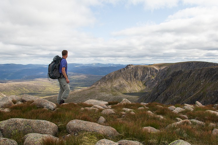
The great eastern massif of the Cairngorms easily matches its neighbours Ben Macdui and the Braeriach-Cairn Toul range for scale and impact, combining grand corries and huge sprawling plateaux to full effect. Both of these two giants are special in a different way. Ben Avon’s upper slopes bristle with weathered granite tors, an array of natural castles. From many angles Beinn a’ Bhuird looks gentle and grassy, but its inner recesses hide a series of epic rock-walled corries. Their remoteness makes an adventure of any trip here, and all possible approaches are a schlep. With a bike and a spare weekend you might come in from the north along Glen Avon; from the south it’s a choice of Gleann an t-Slugain or Glen Quoich. The latter is quicker, and its scots pine woods make for an idyllic approach.
Detailed description

This has been viewed 3,160 times
Download
OS maps and some other mapping apps don't allow waypointsStatistics
Difficulty: SevereDistance: 20.75 miles (33.40 km)
Total ascent: 1,251m
Time: 11 hours (Walking)
to rate this walk.
Summits
Beinn a' Bhuird - Cnap a' Chleirich 1172 mBen Avon - Leabaidh an Daimh Bhuidhe 1171 m
Ben Avon - Carn Eas 1089 m
Beinn a' Bhuird 1179 m
Additional Information
Start/Finish:Linn of Quoich car park, NO118911
Nearest town:
Braemar
Terrain:
Straightforward tracks in the lower glen, with a clear path up Beinn a’Bhuird and easy striding on the tops – but navigation across the plateaux needs attention in mist. Descent from Carn Eas is steep and pathless, and there’s some rough boggy ground in the woods by the Quoich Water. After heavy rain or snowmelt the three river crossings described here may be problematic. At stage 2 it might be necessary to divert upstream to find a safe place to cross, and if this is the case then at stage 7 stay south of the Quoich Water to avoid having to tackle any more fords.
Seasonal variations:
The exposed high plateaux are featureless in a whiteout, and the heavily corniced corrie headwalls a lurking danger. Beware cornice and possible avalanche risk on lower slopes too, such as the descent of Carn Eas from Ben Avon.
Weather and Hill Conditions: mwis: Cairngorms & Monadhliath – Met Office: East Highlands
Guidebooks:
Great Mountain Days in Scotland by Dan Bailey (Cicerone)
Maps:
OS Explorer 404 (1:25,000), OS Explorer 387 (1:25,000), OS Landranger 36 (1:50,000), OS Landranger 43 (1:50,000) Directory Listings:
Find more Listings near this route Tourist info:
Braemar (01339 741 600); Crathie (01339 742 414)
Further Routes
by Dan Bailey UKH
- A' Chralaig and Mullach Fraoch-choire 4 Dec, 2023
- Meall na Teanga & Sron a' Choire Ghairbh - The Loch Lochy Munros 6 Nov, 2023
- Bynack More 19 Oct, 2023
- Beinn a' Mhuinidh 4 Oct, 2023
- Loch Ossian round - Seven Munros by Train 15 Sep, 2023


