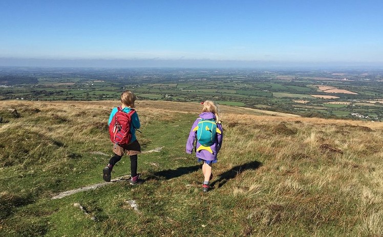
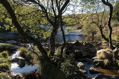
This is a varied and interesting circuit based around Cosdon Hill (or Beacon, depending who you ask), a big granite dome on the northeast fringe of Dartmoor with views that span the moor’s bleak interior to one side and the rolling farmland of Devon to the other. On a clear day it’s possible to see both the English and Bristol Channels. From stone-walled field systems to scattered prehistoric remains, Dartmoor's rich human history adds a fascinating depth to any walk here.
Fetching Map
Height Profile
metres / Distance
miles
Detailed description
1
SX6581591589 Take a well used path southwest, ascending gently through heathland on the southern side of the stream, into the little valley of the Blackaton Brook . A little rough and wet in places, the path soon leads to the Shilley Pool, a popular local swimming spot (good natural water slide, albeit a bit shallow to properly swim). Cross the stream above the pool and look for a rough path that climbs steeply north, close to the trees on the boundary between pasture and the open moor. Soon a grassy path leads left through the heather and stunted gorse, on a rising traverse west-northwest out of the valley. There are a number of possible trails, some sheep-made, but the general gist is obvious. It's worth detouring to the stone row at spot height 428m (1:25k map), a triple row (most are only double). There are over 50 of these prehistoric rows on Dartmoor.
2
SX6437591562 At the head of the Blackaton valley is Raybarrow Pool, one of Dartmoor's more notorious mires. This is well worth avoiding. Skirt to the north and then west of the bog (hard to stay completely dry shod) to reach the southeast flank of Cosdon Hill. It's possible to climb the hill direct, but easier going if you pick up one of a number of trails that all make the same rising traverse onto the southern flank. Join a path heading north for the long gentle climb to the huge summit cairn, and a wide view over Devon.
3
SX6359991468 The main path descends roughly north, at first past a lower cairn on the northern side of the summit area. It's actually a little to the right of the main route as marked on the 1:25 map. Staying with the well-used path gives a quick return to the valley, but with time in hand the longer circuit described here is worth the effort.
4
SX6359792523 Having descended about 100m, and roughly 1km distance from the summit cairn, the path reaches a level shoulder of the hill, overlooking the village of South Zeal. Here cut off left, bearing west-northwest over the open heath. It's rough and in places boggy, but you're likely to find the odd sheep path heading in roughly the right direction. Aim directly for the village of Belstone. After about 1.5km of dead reckoning, pick up a track leading down to Belstone Cleave, the valley of the River Taw.
5
SX6217993359 Turn right on a path along the south bank of the river, following it downstream through the Cleave. With it's clear rushing river and wooded slopes, this is a delightful valley walk. Look out up on the right for Ivy Tor, a free standing rock summit that's worth a quick clamber if you like that sort of thing (uphill face, a corkscrew route starting on the left). Follow the riverside path through the woods, crossing and re-crossing the river on footbridges, down to the village of Sticklepath.
6
SX6436294021 Here turn right and head southeast then south along the road, past one crossroads to a second one in South Zeal. Go right, where the road soon becomes a farm track. At a multiple junction go left, but not hard left, to take a walled track that climbs south, uphill between the stone walled enclosures of an ancient field system. It's a beautiful, secluded route that feels like a step back in time. After about 1.5km between the drystone walls the track climbs onto the open moor not far from the stone row of stage 1. Heading southeast, a trail makes a descending traverse above the upper field boundary to return you to Shilley Pool.
This has been viewed 3,923 times
Download
OS maps and some other mapping apps don't allow waypointsStatistics
Difficulty: ModerateDistance: 8.89 miles (14.30 km)
Total ascent: 548m
Time: 5 – 6 hours (Walking)
Voting:
from 1 votes
Login as Existing User
to rate this walk.
to rate this walk.
Additional Information
Start/Finish:Beside the South Zeal-Throwleigh road, on a grassy lay-by just beyond where the Blackaton Brook passes under the road, and just before a fork in the road. There are a few car spaces near the brook and more room a little further on, SX657916
Nearest town:
Okehampton
Terrain:
Off the paths the terrain can be hard going, with bogs, dwarf gorse and heather underfoot. The 1:25k map is useful for detailed route finding, especially in the woods and stone-walled enclosures of the lower slopes. On the hill itself there are many more paths than shown on even this scale of mapping, so a bit of your own route finding judgement is needed. In poor visibility navigation is very challenging up on the featureless slopes of the hill. Sheep, ponies and cattle graze the open moor so dogs should be kept under control all the way.
Seasonal variations:
It's bleak up on Dartmoor in winter! Watch out for ghastly white mares.
Maps:
OS Explorer OL28 (1:25,000), OS Explorer 113 (1:25,000), OS Landranger 191 (1:50,000) Directory Listings:
Find more Listings near this route Tourist info:
Chagford (01647 432080); Okehampton (01837 53020); Moretonhampstead (01647 440043)
Further Routes
by Dan Bailey UKH
- A' Chralaig and Mullach Fraoch-choire 4 Dec, 2023
- Meall na Teanga & Sron a' Choire Ghairbh - The Loch Lochy Munros 6 Nov, 2023
- Bynack More 19 Oct, 2023
- Beinn a' Mhuinidh 4 Oct, 2023
- Loch Ossian round - Seven Munros by Train 15 Sep, 2023


