Rocktype UNKNOWN
Altitude 343m a.s.l
Faces N
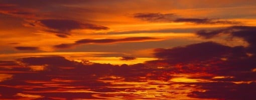
Lava sky from the Catstone © col allott
Summit of this hill
This summit is listed in Marilyns, The Ethels of the Peak District hill lists.
This summit has been climbed in 83 logbooks.Hill features
Bosley Cloud is the prominent hill 5km east of Congleton, marking the boundary between the hills of North Staffordshire and the Cheshire Plain, the boundary between the two counties running through the summit trig point.
The climbing here is of two distinct, contrasting styles; natural and quarried rock. The crags line the Cloud from east to west and can be very green after a wet winter, but on a warm summer's day can be delightful.
Approach notes
Visible from afar, the Cloud can be approached from Congleton, Bosley, or Rushton Spencer, but can be frustrating to reach without a map.
For the northern crags, approach from the car park on the east of the rocks on Peover Lane. A large track runs to the summit from here giving access to the three crags.
For the western crags, approach from Gosberryhole Lane.
Route Cards
|
Summits, Scrambles, and Easy Climbs on this hill
| Name | Grade | Stars | Type | Logs | Partner Ascents |
|---|
These routes you have climbed by seconding or top-roping.
These routes you have Dogged.
These routes you Did not Finish.
Routes are waiting to be checked by a crag moderator, and may not be accurate. Routes can't be verified by a crag moderator, and they need more information to confirm it. Routes are no longer climbable.