


The Big Routes Ossian's Magnificent Seven
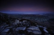
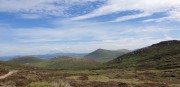
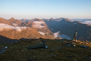
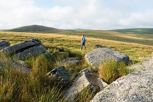
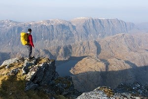
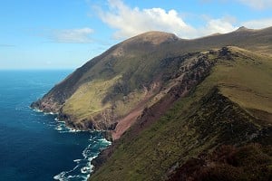
With only a raven for company, Dan Bailey enjoys a wild seven-Munro circuit of Ben Alder, Geal-Charn and the Ossian hills, in the wide open spaces bordering Rannoch Moor.
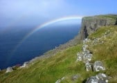
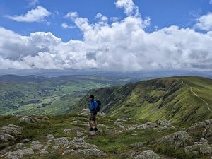
Lizzie Enfield completes the Mourne Wall walk, a classic 35km circuit following the famous stone wall over 15 spectacular granite peaks, including Northern Ireland's highest.
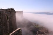
From the top of the Slieve Binnian the Mourne Wall dips and rises before summiting Moolieve, clearly delineating the way ahead. This immutable 100-year-old structure is one of the few continuous features which can be picked out even on one of the area's many low visibility days, and fittingly has been dubbed "the handrail of the Mourne Mountains."

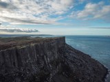
Up to 4.5m high in places, and around 35km long, the wall runs in a rough circle through the range, sticking to the spectacular high ground on the watersheds of the Silent Valley and Annalong River. Keep it in your sights and you can't go too far off course. Follow its route as it crosses the southeastern corner of County Down and you have an easy to navigate walk, but one that's full of drama, following Northern Ireland's answer to China's Great wall.
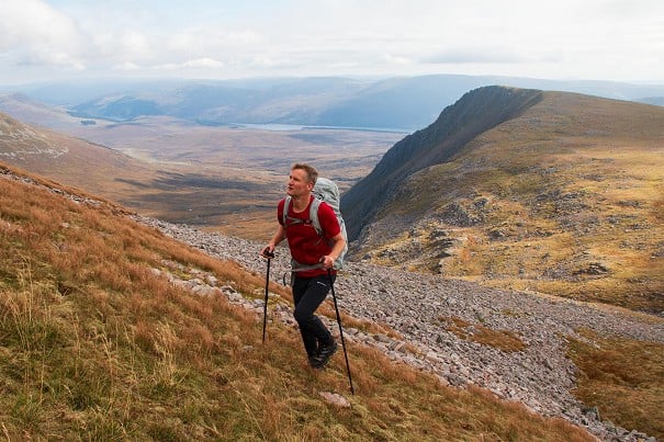
Hardy hikers do the circuit in one fell swoop, but our two-day round with its overnight wild camping made for the perfect weekend adventure
But what you gain in simplicity of route finding, you make up for in the demanding nature of the route. There are plenty of shorter walks that take in just one or two of the many peaks, but the Mourne Wall walk is a series of steep uphills and descents taking in 15 mountains including Northern Ireland's highest, Slieve Donard at 850m.

I am walking it in its entirety over two days with a small group and, although I am an experienced hillwalker, it's a challenge. By the end of day one and 11 hours of up and down in relentless rain, I am soaked through and having to pull myself and hefty backpack up with my hands to the summit of Slieve Meelbeg. My legs have had enough. I stumble and fall on slippery boggy ground a few times as we walk, in the last remaining light, to the col where we put up tents in the dark and are too tired to cook.

Our group is led by Peter Rafferty, a local mountain guide who knows the Mournes inside out and once a year leads anyone hardy (or fool) enough to attempt the walk around the entire wall. Like all mountains the Mournes are subject to the vagaries of the weather, and there are no waymarks in the rugged terrain other than the wall itself. With Peter along to do the actual guiding, I am glad to be able to focus on where to put my feet (and hands) and not have to worry about details such as whether boggy terrain is OK to cross or must be circumvented.
The following morning the rain and mist have cleared and we emerge to spectacular views across the Silent Valley Reservoir and over Donard to the coast. We can now also see the wall snaking its way around the mountains, a welcome navigational aid even if seeing the route more clearly is slightly daunting.

The Mourne Wall was completed in 1922, the year after Ireland, with the exception of the Ulster provinces, was granted home rule. Its location, in County Down close to the border with the Republic, might lead you to believe it was built as some sort of strategic fortification, as Hadrian's Wall or Offa's Dyke demarcated ancient borders.
But the Mourne Wall's more prosaic purpose may be something of a surprise. It was constructed by the Belfast Water Company to keep cattle from contaminating the nearby Silent Valley and Ben Crom Reservoirs in the days when there was no water filtration.
It also provided much needed work during an extremely lean time, just as the Beinn Dearg Wall and others in Scotland gave employment to starving crofters during its construction in the 1840s.

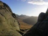
Now a listed building, the Mourne Wall took 18 years to complete. Stonemasons used the area's natural granite. Evidence of its creation is visible in the grooves on rocks, which Peter points out, where plug and feather tools were used to split the stones. We also pass smithy huts used to make chisels, and rocks with carved hollows known as 'fizz troughs'. In these, the anvil-heated implements were cooled and hardened.
Watching the clouds that swirled around the peaks, it was easy to see why they have inspired legends, poetry and song and perhaps most famously the fictional land of Narnia, created by Belfast born C.S. Lewis
Distance: 35km (22 miles)
Ascent: 2860m
Start/finish: Carrick Little, Silent Valley Mountain Park or Meelmore Lodge
Guidebook: The Mourne and Cooley Mountains - a walking guide by Adrian Hendroff
Map: OSNI Discoverer Map Series (1:50,000) sheet 29
For more on the Mournes see Adrain's article:
For more information on the area and other routes visit www.walkni.com
Lizzie Enfield travelled as a guest of Walk the Mournes www.walkthemournes.com
In the mountains themselves you can see green gashes were the rocks were cut. Men walked miles from the surrounding villages and often slept out for days on end, bringing with them potatoes and cold porridge slices for sustenance. It was a bitter, backbreaking job, which made me think twice before complaining too loudly about shouldering camping gear - or the temperature as we settled down for the night after the first 12 miles walking.
Hardy hikers do the circuit in one fell swoop, but our two-day round with its overnight wild camping made for the perfect weekend adventure.

In the sixties and seventies the Mourne Walk was an annual event attracting up to 4000 people on a single day, but the footfall began causing damage to the ground near the listed building and the event was cancelled. These days the occasional small group takes it on, whether guided or DIY, but most of the footfall in the range is from hikers taking shorter walkers encompassing smaller stretches.
In the sunshine, our second day walking felt easier, at least at first as we descended Slieve Meelmore into a valley of cloud and began climbing once more up the steep craggy slops of Slieve Bearnagh.
Our last and final climb of the day would be the biggest and as we neared Slieve Donard the route became busier with walkers up from the nearby seaside resort of Newcastle for a days hiking. Donard is a big draw - the way highest mountains tend to be - and the steps cut into the mountainside made for a different ascent, though I felt by this stage that it wasn't getting any easier. When we reached the top there was a round of clapping, not for us but for a young girl doing her first big walk.

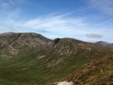
From the top the weather was clear enough to look back across the entire range and pick out each of the fourteen peaks we had climbed during the previous two days. The Mournes are comparatively 'young' granite mountains formed some 50 million years ago. Since then erosion and deposition during a series of ice ages has shaped and sculpted their distinctive forms. These were easier to admire with no more ascents in our sights.
Watching the clouds that swirled around the peaks, it was easy to see why they have inspired legends, poetry and song and perhaps most famously the fictional land of Narnia, created by Belfast born C.S. Lewis.
I had a slight sense of searching for the wardrobe door when, after a two-hour walk down from Donard back to the part of the wall where we began, we left it and headed back inland.
"Fancy going round once more," someone asked. But the remark was met with little enthusiasm. By this time, there was another type of Irish building in our sights… One that was built to serve beer.

The Mourne Wall is just one of the UK's walls which makes for a great hiking trail. The following walks pass through diverse landscapes, passing alongside structures that not only provide a navigational aid but offer up a wealth of history.
Hadrian's Wall
A 73-mile national trail follows the path of Hadrian's Wall from Wallsend on the River Tyne in the east to Bowness-on-Solway in the west. Building by the Romans began in AD122, with the purpose of defending the province of Britannia from the troublesome Caledonian tribes.
A UNESCO heritage site, a significant proportion of the wall still stands and can be followed across fields and moorland, through wooded copses and city streets. It's relatively easy walking although the 23-mile central section between Cholleford and Birdoswald involves a series of steep ascents and descents.
Offa's Dyke
More earthwork than wall, this fortification, named after the Anglo-Saxon king of Mercia who ordered its construction in AD757, delineated the border between Mercia and the Welsh Kingdom of Powys. Today the dyke is a protected scheduled monument and much of its route is followed by Offa's Dyke path, a 177-mile long distance route than runs between Liverpool Bay and the Severn Estuary.
Walking is moderate and the trail winds back and forth as it passes through two Areas of Outstanding Natural Beauty, the Clwydian Range and the Shropshire Hills. Limestone quarries, Iron Age hill forts and the imposing Pontcysyllte Aqueduct offer a glimpse into the complex history of this beautiful border region.
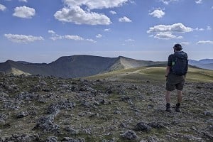
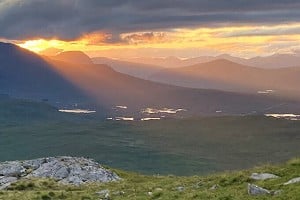
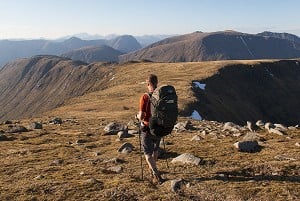
Beinn Dearg Wall
Like the Mourne version, this highland wall which runs for several miles along the east-west ridge on Beinn Dearg in the Northwest Highlands also provided much needed employment. Built in the 1840s, this fine dry stone dyke, up to six feet high in places, is one of the area's 'destitution walls.' After the Highland clearances, which coincided with a potato famine, starving Highlanders were forced to work for little or no purpose building walls in exchange for food.
Accommodation Advertise here
No Premier Listings found in this area
Instructor/Guides Advertise here
No Premier Listings found in this area
Outdoor Shops Advertise here
No Premier Listings found in this area


Comments