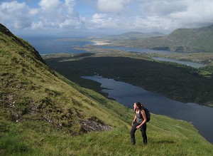
International Prominence - hill bagging taken to extremes

© Denise McLellan

Some of the UK's more ambitious hill baggers combine British lists with international ascents. They are members of an active worldwide bagging community focussed on mapping, listing and climbing peaks as defined by their prominence relative to adjacent summits, rather than their absolute height above sea level. This network regularly shares data, and occasionally meets to combine resources to achieve trickier summits.  

By basing trip objectives around prominence-based lists, mountaineers and hikers can develop a meaningful set of hill-bagging objectives in a relatively small geographical area, going by whatever prominence category they choose.  

Richard McLellan on Norway's Store Lenangstind  © Mark Tengove
Richard McLellan on Norway's Store Lenangstind
© Mark Tengove

Given that these hills are relatively prominent, they tend to have great views. Often the interest is not technical, but just identifying a route and communicating with locals can be challenging. Sometimes they are slightly puzzled why you are there at all! Many peak objectives are off the beaten track, with all the joys of route-finding and remote terrain. 

International trips need not be expensive or complicated, though they can be. We found that a pre-COVID trip to Spain bagging peaks with a minimum prominence of 1000m was simpler and cheaper than an island bagging trip to Scotland. In contrast, a trip to bag one of the most remote European mountains with a prominence greater than 1500m (Beerenberg, Jan Mayen) was much more complex:

European Ultras, taken to extremes - Beerenberg, 2277m, P2277m, Jan Mayen, June 2019

The speck on a map on the middle of the Arctic Ocean which is the ultra-prominence called Beerenberg has had a fascination for me for some time. The Peakbagger website says that geopolitically it's not in Europe, yet being between Svalbard and Iceland, it's an obvious aspiration for anyone who wants to climb European Ultras.

Traversing the crater rim of Beerenberg   © Denise McLellan
Traversing the crater rim of Beerenberg
© Denise McLellan

After several false starts, a group of 10 of us chartered a 15 berth 50m metal-hulled yacht called 'Valiente' through a Norwegian company called Seil Norge. The plan was to sail four days and 570 miles to Jan Mayen island, land, ascend Beerenberg and a few other peaks, leaving the crew on board, and then sail back, all in two weeks. As is familiar to island baggers, landing was absolutely not a guarantee, and the prospect of seasickness both ways was included in the price. Weather was uncertain with gales, low cloud and poor snow conditions highly possible. And, of course, Beerenberg is a volcano classified as 'dormant' not 'inactive,' with eruptions recorded several times in the last 50 years. The island has no fresh water supply.

The yacht had three professional crew, but we were expected to assist with general duties. The crew and five of the mountaineers were Norwegian, with one Finn, one American (Greg Slayden of Peakbagger website) and four Brits - Richard McLellan, Chris Ottley, Tony Jenkins and me.   

We were greeted at Longyearbyen airport, Svalbard, by a huge stuffed polar bear and a warning not to leave the town's boundaries without a gun. Luckily, polar bears, after whom Bear Mountain (or Beerenberg) was named, have long left Jan Mayen island.

Preparing the Valiente for departure at Longyearbyen  © Denise McLellan
Preparing the Valiente for departure at Longyearbyen
© Denise McLellan

We soon adapted to life on board, taking turns to cook, make bread, wash down the decks and assist at the helm as we preferred. We learned that those who take seasickness tablets were not seasick, but full marks to Chris and Tony for acting as controls! Actually, the weather was fairly kind to us with light winds and motoring most of the way. The water generator malfunctioned which meant showers were limited but it was generally a comfortable, warm boat with en-suite cabins. We spent much time discussing equipment and approaches to the mountain, trying to plan for all possibilities. There was, of course, no mobile phone coverage, but we got a forecast by satellite phone each day. We saw almost no other ships the whole trip but did get great whale sightings.

Finally, at 01:40 on 11 June 2019, day 4, cloud-topped rocky cliffs came into view. It was our first sight of land since Svalbard. As we had lost any real sense of day and night in the 24-hour daylight, and the weather was relatively calm, the decision was made to attempt landing immediately. The crew felt this was the riskiest bit of the trip and insisted we wore full survival suits as we were ferried ashore on a tiny rubber dinghy with outboard. As the beach (of volcanic grit) shelves very steeply, we had to wade ashore, feeling any moment that the buoyancy of our suits would 'capsize' us. Loads of kit and food for an army was also brought ashore in large waterproof sacks.   

After all the planning it was simply magical to have arrived in this dramatic amphitheatre. Walrus Bay was backed by steep grey cliffs disappearing into cloud. Huge, bleached whale bones protruded from the grey volcanic sand and gulls called as they soared above in the swirling greyness.

Jan Mayen island has a permanently staffed Norwegian weather station; the following morning most of the base crew came to visit us as they get few visitors during their six-month posting here. The non-Norwegians had to get formal permission to stay and our passports were duly stamped. The base crew told us the forecast for the next few days was exceptionally good and that we would soon climb above cloud into sunshine. They stressed we had to be self-reliant as they had no means themselves of getting off the island.

Bivvy on the side of Rudolftoppen  © Denise McLellan
Bivvy on the side of Rudolftoppen
© Denise McLellan
 

So we decided to start out summit attempt that day at 16:30. The landing bay is around 30km from the peak and although there is a gravel track around the coast, the route goes up and down over the mountainous spine of the island. Carrying three days of food, bivvy stuff plus glacier gear meant we had heavy packs. 

We were all feeling weary at 22:30 when we suddenly left the valley of fog and entered a mountain of sun and bright snow. The transformation was uplifting! At 23:30, at 650m, roughly at the snowline we bivvyed in bright sun; the views of sharp snowy ridges all around us were amazing. I could hardly believe our luck with the weather.

We set out at 08:30 the next morning, leaving bivvy gear behind, and crossed the snowfield. We roped up where the angle changed and crevasses appeared. It was a straightforward plod in sunshine up the snowy mountain, zigzagging to avoid obvious icy slots and manage the steepness - such a joy to see the whole island above the cloud level.  

Finally, at around 16:00, we reached the mighty crater rim, seen from our bivy site, and I realised we really were going to make it. We added crampons for the final icy crest walk to the small, domed and snowy summit and let out a whoop of delight as we reached it, drinking in the cool crisp air and stupendous snowy views.

Then it was time to go down. The cloud briefly lifted off the whole island revealing the coastline - a rare sight indeed. However, the sun made the final snowfield very porridgy. We regained our bivvy site at around 21:00 and had another dried meal and rehydrated, before going to sleep in the brightness, getting burned lips, but drying soaking socks on a rock to a crisp.

Puffin on Kvalrossen  © Denise McLellan
Puffin on Kvalrossen
© Denise McLellan

The crew warned that if the forecast changed we might have to leave the island at short notice, but in fact we spent a further four days on land exploring the other even less frequently ascended peaks in small groups, bivvying out above clouds in continuing amazing stable, sunny, dry weather and enjoying a unique feeling of remoteness. In total I walked 95 miles on the island, ascending 14 (some did 16) P100ms (of 18 in total). This number includes two P600ms and the one P1500m ultra prominence.

The lower terrain was most unusual with thick, unstable moss, with some warm and sulphurous gravel patches. Higher up there was snow. We saw lots of birds - puffins, terns, fulmar, great skua, arctic skua and little auks - and some interesting World War 2 defences, amazingly preserved by the cold. It's said to be the only part of Norway not controlled by the Germans during WW2, but the defending troops must have felt very isolated!

The return sail had some final, unexpected excitement. On the second day, in stronger winds and rougher seas, the crew announced that a 'Russian' canvas trawler bag had become caught in the propeller and we could not use the engine. We thus set sail for Bodo, and later Tromso, in northern Norway, many miles further than planned. Luckily, contrary to the forecast, the sea calmed 24 hours later, and the determined crew cut the bag off (2 hours in the cold water). It then transpired that the prop shaft coupling was damaged, and we could only go at low speed. We cooked waffles to boost morale. However, the wind obliged, and the crew also eventually managed to repair the coupling, such that we actually arrived in Longyearbyen only 18 hours later than planned.      

Svalbard is a wild 'frontier town' of migrant miners, tourists and reindeer and also a Norwegian tax haven. This makes it just affordable to drink alcohol there. So, it was with mixed feelings that we said goodbye over a beer that night, all delighted that we had achieved our objective with no serious mishap.


The most common prominence-based lists pursued internationally are:

  • Ultras – with over 1500m of prominence
  • Ribus – with over 1000m of prominence
  • Majors - with over 600m of prominence

Denise on 2900m Tete de L'Estrop in the Provence Alps   © Mark Trengove
Denise on 2900m Tete de L'Estrop in the Provence Alps
© Mark Trengove

In addition, lists of ascents of the World Top 100 by prominence, P2000m, P500m, P300m and P100m are also collated (P = Prominence).

There are a number of useful sources of information:

  • What is prominence? For more information about prominence see a simple explanation on the UK Relative Hills Society website. The Relative Hills Society is a UK-based society which promotes prominence based hill-bagging, particularly in Britain. Its members share information and arrange joint trips. RHSoc also publishes Halls of Fame of number of ascents, in relation to its members and associates only, for Worldwide Ultras, Ribus and Majors each year.
  • For a more detailed examination of the topic see the Wikipedia Topographic prominence page
  • Peakbagger - Used by many international mountaineers (especially European and American) to log international ascents and trip reports. Run by USA-based Greg Slayden, the website creates 'front runner lists' in which climbers can compare progress against each other. Many of the lists included are prominence-based. There is an excellent associated mobile app for use.  It is an invaluable source of information.
  • Baggers without Borders (BwB) - An international community of baggers who aim to share information to promote international prominence-based lists. Run by UK-based Mark Trengove, BwB publishes annual halls of fame and progress registers, highlighting relative achievements in various international ascent lists (the 2020 Tables can be found here, and subsidiary pages). It also contributes to an international peak-listing project, aiming to improve the quality of prominence-based international lists in less well-mapped/climbed areas. There is also a Google chat group through which members share information. To join, contact Mark via the link at the bottom of this page.
  • Mountain Views - All you could possibly want to know about hill-bagging in Ireland.
  • Front Runners list - Shows progress on important Prominence lists, both worldwide and by country. The lists are kept regularly updated.  Run by USA-based Andy Martin.  This is a text/HTML file - you will need to open it after clicking on the link to left. It may be easier to access on a PC than a smartphone.
  • Top 50 Ultra Prominent Peaks of the World - Another fascinating list, regularly updated by UK-based James Stone.
  • Peaklist - This website gives an insight into the work that has gone in to map the world and identify prominence, using what was then rapidly-advancing computing. It has been the source of much of the data on other international mountaineering websites.
  • Viewfinder – a website devoted to relative summit listings, maintained by UK-based Jonathan de Ferranti.


Loading Notifications...
Facebook Twitter Copy Email