


Destination Hillwalking in Wild West Texas
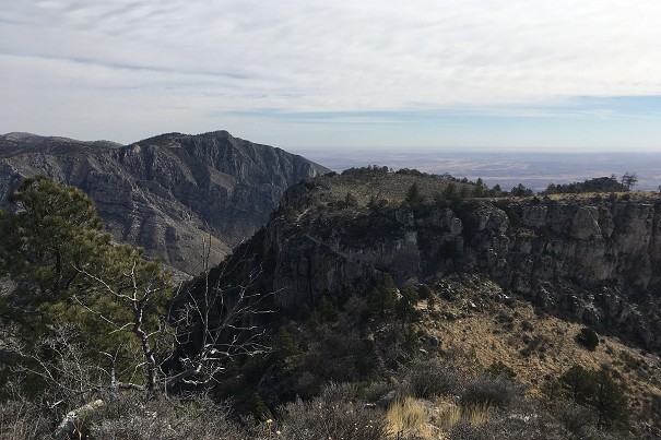
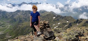
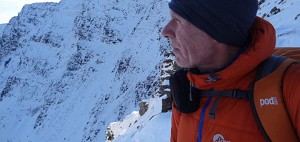
In Spring 2022, Munroist Ian Robertson went to the desert hills of west Texas in search of something a bit different, and ended up having one of the best trips of his 30-year hillwalking career.
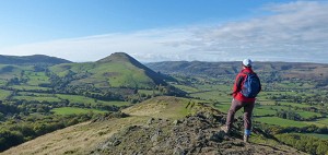
North of the Scottish-English border lies some of most underrated hill country in Britain - and there's heaps of it! Let Ronald Turnbull be your guide to this neglected expanse of rolling hills and empty glens.
"Every valley has its battle, and every stream its song," Walter Scott wrote in 1830, while inviting a friend to visit at his Abbotsford house beside the Tweed. In the turbulent times of Scottish Independence after Bannockburn, the wide country between Galloway and the Tyne reverted to an earlier time of local warlords, and an economic system based on blood feud, kidnapping for ransom, and straightforward theft.

And so on an autumn afternoon, we find Sir Simon Musgrave, the Captain of Bewcastle in the northern wastes of Cumbria, riding north over the grassy tops into Scotland. The Captain is one of the officers charged with keeping the peace on the Border. But that's just the day job: at night he's a cattle raider like everybody else. And Dod Head in the Ettrick glen is a tempting target, the defensive pele tower being manned by just one man, Jamie Telfer.
And whan they cam to the fair Dodhead,
Right hastily they clam the peel;
The loosed the kye out, ane and a',
And ranshackled the house right weel.
Which leaves Jamie Telfer of Dodhead, off on a ten mile run over the hills to Stobs Castle, south of Hawick, in the dark, to visit the local warlord, Gibby Elliot.
The sun was na up, but the moon was down,
It was the gryming of a new fa'n snaw,
Jamie Telfer has run ten myles a-foot,
Between the Dodhead and the Stob's Ha'

Under the system of blackmail (mail meaning rent) Jamie has been paying the Elliot protection money; and Elliot is now obliged to recover or else replace the stolen cattle. For his night run Jamie may have used the old drove track, southwards from Ettrickbridge, waymarked today as part of the Ettrick Trails.
But claiming on the insurance was no easier in the sixteenth century.
"Gae seek your succour at Branksome Ha',
For succour ye'se get nane frae me!
Gae seek your succour where ye paid black-mail,
For, man! ye ne'er paid money to me."
Elliot, it appears, has no record of the premium payments…
The fate of Jamie and his cows is recorded in the Border Ballads collected 200 years later by Walter Scott – himself descended from one of the most dreaded Border clans.
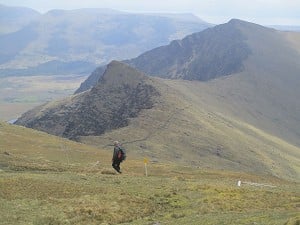
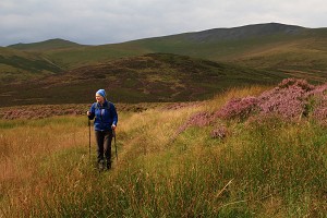
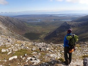
The high country is crisscrossed with green pathways. These were once busy with Roman soldiers, long-striding saints and cattle thieves. Today they're kept open by walkers who value the solitude below the wide skies

But more than that, you can read it in the country itself: the pele towers and the fortified farmhouses known as bastles; the sturdy Border townships with their seven-a-side Rugby and riding of the marches; the truce cairns along the border ridge where disputes could sometimes be settled without anybody needing to get killed with a spear. And above all, in the emptiness even today of the long valleys with their winding silver rivers and hillforts on the horizon: Ettrick and Yarrow, Moffat Dale and Manor Water, Breamish and College and Coquet. Oystercatchers beep among the banks of shingle, and the curlews shriek and moan above the wide moors.
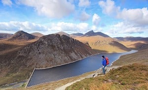
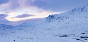
The high country here is crisscrossed with green pathways. These were once busy with Roman soldiers, long-striding saints, cattle thieves and the occasional wandering salt salesman. Today they're kept open by the shepherd on her quad bike – but also, increasingly, by walkers who value the solitude below the wide skies and the lonely cry of the plover. Here too is upland more austere: nodding cotton grass, dark heather stalks, silver puddles and black peaty bog. Such country has its own bleak charm, but it's often the lower hills, shaped and drained by the valley sidestreams, that give the most rewarding walking.

Approached out of England, the Cheviots are remarkably remote. Not only do they lie further north than some parts of Scotland; they are hidden away behind the UK's largest wood pulp plantation, and the red flags of the Otterburn military ranges. In the off-season especially, their national-park status is belied by the loneliness of the long, green valleys.
It's these valleys that give the Cheviot Hills their character. Alwin and Coquet flow south to the Tyne; Breamish is still in England but runs northwards to the Tweed. Each has its tiny tarmac road, crossing and recrossing its stream, dodging around a gorse bush to reach another lonely farmhouse. And at each valley head, older roads head upwards into the hills; Roman Dere Street, Bronze Age Clennell Street, or the green paths of those 16th-century cattle thieves.
But not just the valleys. Also characteristically Cheviot are the steep sided, grassy topped hills that rise above them at every wiggle. Iron-age man and woman appreciated these every bit as much as hillwalkers of today. Ancient green pathways run up into the hollows, and half of the hills are topped off with a hill fort.

Winding valleys, ancient settlements – are we forgetting that the Cheviots are (the clue's in the name) a range of hills? Maybe we should – as so many of the highest points are flat places of peat and heather. The black swamp that forms The Cheviot itself is rather easier to appreciate, as it's crossed by a stone-slab path.
The valleys on the northern, mostly Scottish side are shorter and steeper. This goes back to the glaciers, with south-westerly winds dumping heavier snowfall on the downwind slopes. They run out into the wide vale of the Tweed, with small towns like Yetholm (in Scotland) and Wooler (in England). Instead of long half-hours following the satnav out along single track roads, here are pubs, cafés, shops and hostels right at the toes of the green ridges.
And if those green ridges should be grey under the rain, just look north again. The Tweed itself and its tributaries offer fine low-level walking.
Best Walks: Any of the valleys has car park places and ridgelines up into the high hills. Try this border raid from the south:
The Dee, the Don, the Spey; the Tweed, the Forth, the Tay – the old rhyme makes the Tweed the fourth of Scotland's great rivers (the fifth, of course, being the Forth). As the Cheviot Hills peter out north of Wooler, the Tweed takes over their task of marking the international boundary; then for its last few miles it runs out into England.

When it comes to separating Scotland from England, the Tweed serves its purpose as impressively as the Cheviot Hills above. (And yes, the dog walkers on the north bank will greet you in Scots, those on the other side in Geordie.) It runs wide and smooth, with carved out sandstone on the curves, and quite a few castles and abbeys.
And the great river is the guiding line of a wide valley plain between the Cheviots and the Southern Uplands. River silt forms rich farming country, dotted with red sandstone villages, along with handsome border towns like Kelso and Melrose. A whole long-distance path, the 100km Borders Abbeys Way, is contained within the valley floor. And little islands of rugged volcanic rock, the Eildons and Rubers Law, represent the remains of ancient volcanoes above the Old Red Sandstone of the valley below.
Best Walks: Riverside paths of Tweed and Teviot: ideally combined with one of the miniature hills.

West of Selkirk, we're in the Southern Uplands. And now the Tweed is paralleled by two important tributary valleys to the south. Valleys they are of song and ballad, where the Kings of Scotland hunted the deer, where the Captain's men in their steel bonnets rode over the hill driving Jamie Telfer's cattle, where witches ran through the meadows in the shapes of hares and greyhounds, and where in all Scotland the fairies lingered longest among the green knolls and hollows.
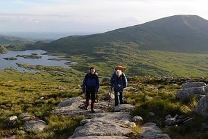
Above the 500m mark the hilltops are mostly grassy, often with delightfully easy going. The carved valleys sink out of sight, and it's green or winter-beige ridges, one behind the other, stretching half way across Scotland.

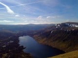
Ettrick is the southern of the pair. Long and narrow, it winds into the hills with a single road alongside its sparkling river. The interest here is at its head, where small but well separated hills form a ring around the carved ravine of Selcoth Burn. North of it runs the wider, more open Yarrow valley, with the A708, quietest of main roads, running along it, and two fine lakes, Loch of the Lowes and St Mary's Loch.
Best Walks: Ettrick Head, St Mary's Loch and above, the Minch Moor.
Above Innerleithen the hills close in; and the upper Tweed is a hill river. High in the Moffat Hills it rises at the back of the Devil's Beeftub. The Moffat and Manor Hills each form a compact group of 600m summits, rounded and grassy and linked by high, gentle ridges.

Reached from Peebles, the northern Manors are well drained by steep wee glens. They are firm underfoot and covered with heather. It's delightful country to roam around – if you happen to be a honeybee. Happily, the main ridges have good paths, allowing the eyes and nose to enjoy the August flowering without the feet and legs getting nastily tangled up in it.
Southwards, the linking ridge that forms the highest part of the range is wider, flatter, and in places peaty. The whisky aroma of the place lingers into the evening as it dries black on your well used gaiters.
After many miles of grassy or boggy ridgeline, the Manors culminate in Broad Law – a Corbett (Scottish 2500-footer) and the high point of the Southern Uplands in altitude if not in excitement. The Moffats include the other two Corbetts: Hart Fell and White Coomb. Each of the two is full of interest, whether it's the romantic hollow of the Devil's Beeftub, the cragged hollows of Black Hope, or the somewhat knifelike grass ridgeline of Saddle Yoke, along with one of Scotland's finest waterfalls (the Grey Mare's Tail), the Southern Uplands' highest loch, and a whole valley replanted with Scotland's wildwood.
The typical day out will combine a ridgewalk over two or three of the grassy summits with a return along one of the steep little valleys; to re-emerge beside the Tweed in the west and north, the Manor Water to the south, or the Talla glen between the two groups.
Best Walks: Anything from Peebles, including very long walks turning at Broad Law; anything on Hart Fell and/or White Coomb:
Jamie Telfer, you'll be pleased to hear, found himself a new warlord, Scott of Buccleuch at nearby Branxholme Castle. A large force gathered for the 'hot trod', recovering Jamie's cattle and following up by breaking into Bewcastle and stealing the Captain's herd as well. As for the Captain himself:
The captain was run thro' the thick of the thigh,
And broken was his right leg bane:
If he had lived this hundred year,
He had never been loved by women again.
The moral is this. Enjoy the Scottish Borders for their fine walking country, on hillsides and riversides and peaty moors. Along the way you may pass many splendid and covetable cows.
Just don't be tempted to take them home with you.

Ronald Turnbull's new guidebook Walking in the Scottish Borders includes the great Tweed Valley and its surrounding hills: the Cheviots (Scottish and English), the Ettricks, Moffats and Manors.
The guide presents 45 day walks and one long distance route. The walks are a mixture of high and low level routes and can be fully customised using multiple variants.
Due to be published by Cicerone mid August - available to pre-order now.
Accommodation Advertise here
No Premier Listings found in this area
Instructor/Guides Advertise here
No Premier Listings found in this area
Outdoor Shops Advertise here
No Premier Listings found in this area
In Spring 2022, Munroist Ian Robertson went to the desert hills of west Texas in search of something a bit different, and ended up having one of the best trips of his 30-year hillwalking career.

Daft online reviews occasionally make it into the mainstream media, and they don't get much sillier than complaints about mountains. Since we're not above laughing at the less hill-savvy, we've mined Tripadvisor for some...


Comments