


Destination Hillwalking in Wild West Texas
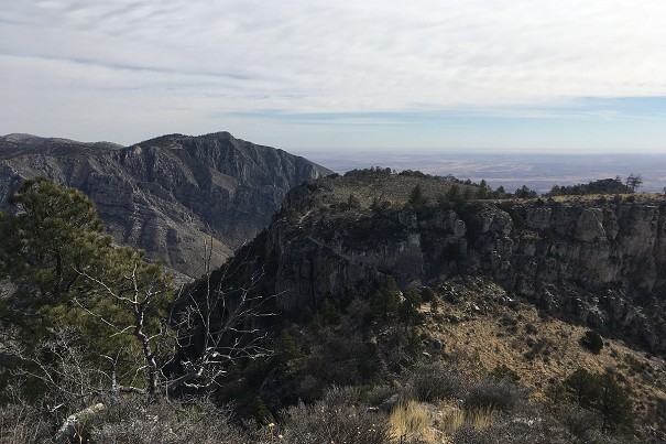
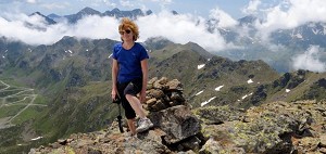
In Spring 2022, Munroist Ian Robertson went to the desert hills of west Texas in search of something a bit different, and ended up having one of the best trips of his 30-year hillwalking career.
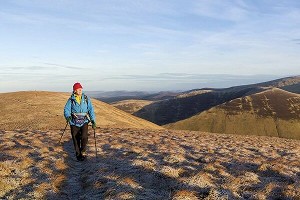
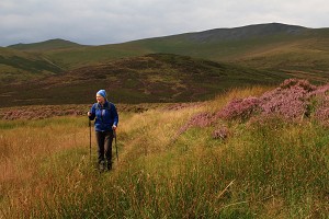
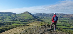
There's far more to North Wales than its summits. Staying low reveals a gentler but no less fascinating side to Snowdonia says Alex Kendall, author of a new guide.
In a move that went down well with defenders of Welsh independence throughout history, geology took a hiatus from the surrounding rolling hills of Shropshire and Mid-Wales, and thrust up into the sky a mountain range of jagged peaks and thundering waterfalls, where knotted forests would grow on the dark volcanic rock and where the rain, slowly weathering the peaks, would collect into rivers that spread out into estuaries spilling into the Irish sea.

As somewhere that has become famous not only because of its signature mountain, Snowdon, but that has attracted rock climbers and mountaineers for as long as those activities have existed, it might seem odd to suggest that you should go to Snowdonia and experience the valleys, but that is exactly what you should do. Because here are our ancient woodlands and glistening lakes; here is where to find a winding path following streams to the old lairs of glaciers and the haunting places of mythical beasts. And here too, buried in the ages, are the remains of hundreds of years of Welsh culture and the shifting fight for independence and identity.

Where the Conwy Estuary drains into the sea, Snowdonia National Park begins, with the immediate rise of Conwy Mountain and far into the horizon the rolling foothills of the Carneddau, home to wild ponies and ancient stone circles. Conwy Valley itself runs north to south, with flat fields at its base, and steep wooded hills on both sides. This is the land once flooded by the Afanc, a beast later dragged up onto Snowdon by the hero Hu Gadarn, and which now resides in Glaslyn. The valley has many bases for walking, from Conwy itself, to Trefriw right in the heart of the valley, down to Betws-y-Coed in the south, where the river retreats into tremendous gorges.

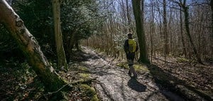
Surrounding Betws-y-Coed is Gwydyr Forest, now mostly a venue for cycling and walking amid the conifers, but formerly a mining landscape that goes back thousands of years, where walkers can find buried in the landscape the old buildings and spoil tips, slowly being reclaimed by vegetation. There are quite a few marked trails here, where even those unhappy with the prospect of using maps can enjoy a foray deep into the forest.
Going further south from Betws-y-Coed you come to one of the hidden wonders of Snowdonia, the Fairy Glen, where the still young Conwy River leaps over the Conwy Falls before gliding sedately through a ravine thronging with ferns and mosses, where you can easily imagine yourself transported back to when ancient forest cloaked the land. Though it's tempting to tick these off by driving, take the walk from Betws-y-Coed instead, and see how the Glen fits into the landscape and the story of the river.
Two great valleys, mostly known for their rock climbing and their assembly of guardian peaks, run through the high mountains of Snowdonia before disgorging cars and travellers over the northern plains surrounding Bangor and Caernarfon, as there once flowed the glaciers of the Ice Ages. The most western of these valleys is the Pass of Llanberis, with its twin lakes next to the village of Llanberis itself, and the brooding Dolbadarn Castle, which dominates the view as it has done since the Welsh Princes used it as their last stronghold against the invading armies of Edward I.

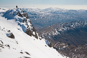
Further east, over the Glyderau, lies the next valley, the Nant Ffrancon, which twists south-east past Llyn Ogwen to become the Ogwen Valley. High up on the edge of the Glyderau hangs the raised valley of Cwm Idwal, a nature reserve unmatched in its floral diversity, and whose lake circuit is possibly the best short walk in North Wales. The incomparable background to this valley is the Devil's Kitchen, a dark cleft from where sailors in the Menai Straight saw the bad weather approaching, and the rocky spire of Tryfan.

Continue through the Ogwen Valley and you'll reach Capel Curig, in the heart of this northern part of the Park, and which gives access not only to the most famous view of Snowdon, but also to the winding paths over the low hills to the north, where it is easy to escape from the busier parts of the Park even on the sunniest Bank Holiday.
Meaning the 'valley of the white stream', Nantgwynant runs east to west, originating at Pen y Pass where you can wander the easy first section of Snowdon's Miner's Track right up to the base of the summit pyramid. From Pen y Pass, Nantgwynant plunges down and runs past the lakes of Llyn Gwynant and Llyn Dinas to culminate in the village of Beddgelert. It is possible to walk the full length of this valley, a journey that takes in the lakes, Snowdon's southerly slopes and the woodland on the northern slopes of the Moelwynion, the hills directly south.
There is more to the valley that just its base though; put in a little uphill effort and you'll reach Cwm Llan, where you can explore the old slate mines right on the slops of Snowdon itself, and see the spot where as Prime Minister, Gladstone opened the Watkin Path. On the way back down on a hot summer's day, there are little things more tempting than the pools and waterfalls of the Afon Cwm Llan for a brief swim, no doubt followed by a café stop in Bethania.

One way of exploring some of the huge variety of Nantgwynant is to start in Beddgelert, walk along the valley past Dinas Emrys, where the legend of the red dragon on the Welsh flag was born, to Llyn Dinas, near where the National Trust is attempting to manage the landscape's competing priorities of sheep farming and the protection of wildlife with a regime of conservation grazing. From here you can either walk over Cwm Bychan, via the ruins of the old copper mine, or progress further and return via Nanmor, a valley with all the peacefulness of sparkling streams, easy woodland walking and the solitude of solo cottages on the slopes of the hills. Regardless of your choice here the walk reaches the Pass of Aberglaslyn, where you can follow the now boisterous Afon Glaslyn past rapids and back to Beddgelert.
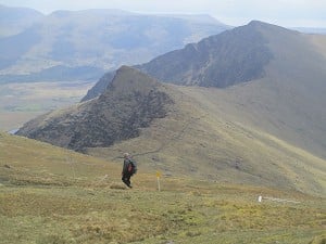
South of Beddgelert, the Afon Glaslyn enters an area heavily modified by man, where the former sandy expanse of the Glaslyn Estuary was silted up by the building of the Cob across the bay towards Porthmadog. These flat farmlands are surrounded by the hills that bump down from Moel Hebog and end abruptly at the crags of Tremadog, and the peaks of the Moelwynion, with the pointed summit of Cnicht their most prominent member.

Though low level walks in these hills are sometimes hard won, there are excellent secret trails to be found, up above Tremadog and Croesor, giving views over the valleys and the estuary while staying far below the windswept peaks. Over the Hebog hills into Cwm Pennant, the kind of place you really have to want to reach as you're unlikely to get there by accident, lies a wonderful circuit of valley walking, past slate mines and woodlands, streams and sheep-fields, that can seem like a lost land far from the rapid changes of the modern world.
One of the most attractive sides of Snowdonia, is that the mountains drop almost right down into the sea on two sides. Nowhere does it feel more exotic than when walking around the coast from Porthmadog, past the village of Borth y Gest with its rocky coastline of hidden bays and vegetation-cloaked cliffs, and along the miles of sand dunes at Black Rock Sands. The turquoise water, white beaches and the ever-present call of seabirds are your companions on the way to Moel y Gest, a stand-alone small hill with views that reach from Snowdon to the beaches of the Llyn Peninsula.

Forming the southern boundary of 'northern Snowdonia', this valley is the true undiscovered haven that awaits walkers keen to discover what real North Wales is about. The town at the head of the valley, Blaenau Ffestiniog, was left out of the National Park, leaving a conspicuous circle on the map. Surrounded as it is by colossal slate spoil tips, it is also the perfect destination to explore the valley. Barely an hour's walk from this old industrial super-town that sent roofing slates around the world you'll find yourself deep in nature, perhaps taking a day to walk the full length of the valley down to Porthmadog.

The Ffestiniog railway, the restored narrow-gauge line that used to run slate down to the coast, is open for the public, and can easily be used by walkers wanting to explore the trails around its many stops. Approximately half-way through the valley it twists and turns to rise up through the woods surrounding Plas Tan y Bwlch, now the Snowdonia National Park's research centre. Here you can walk to old reservoirs that are now wild glittering lakes, and perhaps catch a glimpse of one of the ospreys that has recently decided to nest in the area.
In Wales you are never far from myths and legends, and these often go way back beyond the over-excited way the Victorian's named every other feature after fairies. Coed Felinrhyd, easily overlooked among the other excellent woodlands in the area, is in fact named in the Mabinogion, the medieval Welsh book of stories which were probably oral history long before that, and in which King Arthur makes several appearances. That this has been woodland for as long as we have had written stories should excite even the most modern walker.
When to go
Walking the lowland trails of Snowdonia is something you can do at any time of year. The spring, summer and autumn have their own obvious attractions – warmth, long days, wild flowers and a greater variety of accommodation. But don't underestimate the winter – there are still plenty of guesthouses, hostels and hotels open and some excellent places for food. A crisp winter's day, perhaps with snow on the mountains, makes the landscape appear totally different from the other months. Equally, even getting out on a wet and windy winter's day brings fresh air and an experience of raw nature – good to look back on when you're drying off by the fire in the nearest pub!
Getting there
The main roads into Snowdonia from England are from Chester or Shrewsbury, and from South Wales the A470 runs right up into the National Park. For trains, there is a line that runs along the north coast, and another that comes up from Shrewsbury via the southern portion of the park to reach Porthmadog. There is also the line that heads right into Blaenau Ffestiniog from Llandudno Junction, passing Bewts-y-Coed on the way.
Getting around
While the easiest way is by car, there is a reasonably good bus network in Snowdonia, especially around Snowdon and from there towards Betws-y-Coed. Check out Traveline Cymru for more details, and don't forget about the narrow-gauge railways threading through many of Snowdonia's valleys.
Many walks in the guidebook below are designed to start and finish from locations accessible by public transport, or from villages and towns with accommodation – so why not explore the area where you're staying!
Where to stay
There's an abundance of accommodation in the villages and towns within the north of Snowdonia National Park that you'll be sure to find somewhere that suits you. From Conwy right down to Porthmadog there are multiple options ranging from campsites to deluxe hotels, and everything in-between. While most YHA hostels are based around Snowdon, there are plenty of independents in the surrounding towns as well. The great thing is that everywhere in the National Park has excellent walking opportunities nearby.
Maps
For 1:25,000 OS maps, OL 17 and OL 18 cover the north of the National Park. The BMC also produce a map with Harveys called Snowdonia North, which covers the area at 1:40,000

In Spring 2022, Munroist Ian Robertson went to the desert hills of west Texas in search of something a bit different, and ended up having one of the best trips of his 30-year hillwalking career.

Daft online reviews occasionally make it into the mainstream media, and they don't get much sillier than complaints about mountains. Since we're not above laughing at the less hill-savvy, we've mined Tripadvisor for some...


Comments