


"It's called the Guillaumet pass. It's generally used by climbers. There's a little crevasse danger but as long as the weather holds it'd be fine. You'd be right underneath Monte Fitz Roy."
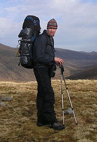
The e-mail I'd opened was from a 29-year old Argentinean mountain guide, Pedro Fina. I'd first met Pedro in 2004, when he was one of two guides I'd had on a 4-week trekking expedition in South America. During that trip, we'd climbed a glacier beside two of the great peaks of the Patagonian Andes, Monte Fitz Roy and Cerro Torre, and traversed a small portion of the Southern Patagonian Ice Cap, a flat expanse of thick ice - 13,000km2 - that flows west from the mountains and down into the Pacific Ocean.
My objective this year was to get much closer to the mountains, to scratch an exploratory itch I have for Patagonia and to research new treks for a guidebook I was writing to Argentina's Los Glaciares National Park. With the help of Pedro and Rolando Garibotti, a US-based Italian-Argentine mountain guide and an expert on Patagonia climbing, I'd settled on a shorter expedition around Monte Fitz Roy, connecting small cirques and climbers' trails with pocket glaciers and high bealachs to create a trek that I hoped would offer me the finest views possible of the Fitz Roy massif.
"I'll pick you up at 7am. There's a 3-4 day good weather forecast and we should take advantage of it whilst we can."
I'd only been in Argentina a day when Pedro suggested we should leave the following morning. Neither of us had any desire to be caught out in a Patagonian storm. The weather in Patagonia is commonly said to be amongst the worst in the world. Dark storm fronts that begin life deep in the Pacific Ocean rampage across the sea uninterrupted, the cold and wet air picking up moisture and gaining in speed as it heads towards a thick belt of low pressure, termed a circumpolar trough, that rings Antarctica. When this trough has expanded over Patagonia, as is all too often the case, the storms are dragged kicking and screaming over the Andes first. It is not uncommon to encounter wind speeds of 160 kph. When this is the case the last place you'd want to be is up in the mountains where, as Gregory Crouch, in his book 'Enduring Patagonia', quotes US climber Jim Donini as saying "survival is not assured".

It was this sobering thought that occupied my mind when, two days later, Pedro and I stood atop the 1700 m high Paso Cuadrado and prepared to descend 400 m of blue, translucent ice to reach the remote and heavily-crevassed glacier we could see far below us. We had climbed the 200 m to Paso Cuadrado that morning, after ascending 1000 m the day before from a private campsite just outside Los Glaciares National Park and spending a dry, cold night beside a huge, black rock called Piedra Negra. Two off Pedro's friends spent the night with us, shivering without sleeping bags as they waited to attempt a nearby peak, Aguja Guillaumet.
By 11.00am Pedro's friends could be a world away. Having carefully descended the ice slope we'd swapped crampons for snow shoes and headed uphill towards the Fitz Roy Norte Glacier. A huge jumble of ice towers, or seracs, spilled out of a higher basin as the glacier broke up and made its way down valley.

Giving this icefall a wide berth we traversed instead beneath a jagged bergschrund that had formed as the ice had torn itself away from the huge granite walls of Aguja Mermoz. Rock-fall was a distinct possibility and more than a few deep breaths were taken before we passed the seracs and could cut back onto the upper part of the glacier. As we did so, everything underfoot turned to pristine white.
Perhaps it was the uncommon lack of wind and the resultant silence or more likely my jangly nerves, but the further I walked into this glacial cirque the more the surroundings began to affect me. It wasn't just that we were far from civilisation - a 2 day walk to the small town of El Chalten unless you could climb expertly - but that if you had seen us we would have been impossibly small. Behind us was the 400m ice slope we had just descended. We had to climb it again later in the day. To our right was a vast wall of ice-clad cliffs, 200 m high, which made up the southern side of Cerro Pollone and Cerro Piergiorgio. Beyond these cliffs was the Southern Patagonian Ice Cap, beyond that only the Pacific Ocean. In front of us was the fourth 'wall' of the cirque, the Filo del Hombre Sentado, or Sitting Man Ridge. At the top of this ridge the ground dropped 700 m to the Torre Glacier before it rose up the other side again to form a 3 km long incisored skyline of agujas, or needles, that culminates in three of the most recognisable and difficult to climb mountains in the world - Cerro Torre, Torre Egger and Cerro Standhardt. Clearly visible from the ridge is the most popular route up Cerro Torre; the so-called Compressor Route, named after the Italian climber, Cesare Maestri, who drilled over 400 bolts into the mountain as he climbed it in 1970. Despite the prevailing weather, and the outcry of many a traditional climber, the bolts are still there, as is the drill itself. It is tolerated by many of today's climbers as an opportune place to stand on an otherwise blank vertical wall. Maestri's original claim to have summited the mountain in better style, in 1959, up the far harder north-east ridge, is still a subject of much debate. This route was not climbed without suspicion until 2005, by the afore-mentioned Rolando Garibotti and two Italian friends, Ermanno Salvaterra and Alessandro Beltrami. Rolando is one of many people who believe, not without reason, that the first people to climb Cerro Torre were a team of Italians, in 1974, via the west face.
All views paled into insignificance however by the massive, 1600 m high flange of granite that rose up on our left. Monte Fitz Roy's huge west face is split in two - as if by a mighty axe blow - by the majestic Supercanaleta, or Super Coulouir.

If you're the American climber, Dean Potter, this 60 degree, ice-filled couloir is regarded as an easy way up the mountain. In 2004, Potter raced from the bottom of the couloir to the summit of Fitz Roy, all 1600m of snow, ice and rock, in a mere 6 hours 29 minutes. He then descended the other side of the mountain the same day. In 1965, the first ascensionists of the couloir, Argentineans Jose-Luis Fonrouge and Carlos Comesana, took a more realistic 2 days, before they descended on their third day through a storm that raged around the mountains for a staggering 36 days. You can be sure this thought wasn't far from my mind as I considered the meagre two days rations I had packed in my backpack.
"The next bit's got the crevasses", Pedro said, as he handed me my obligatory fix of morning coffee. "Great", I said, but I didn't really mean it. Although it was possible for us to have abseiled the Sitting Man Ridge and descended the Torre Glacier back to El Chalten this was way outside the realms of my experience and we had chosen instead to return to Piedra Negra. It was from here that we were headed for Paso Guillaumet, a small notch in the mountains that enabled access across the east-west divide, and from there to another high mountain pass, Paso Superior, that lay right in front of Monte Fitz Roy. Both Pedro and Rolando had told me in their e-mails that the view between these passes was spectacular.
The ground up to Paso Guillaumet was similiar to the previous day; long, steep ice slopes broken up by the odd rock outcrop that we took advantage of for snack breaks. Higher up, we entered a gully system until a large, angular rock blocked the way and we were forced to move out onto a buttress for a few easy pitches of easy rock-climbing.

On reaching the pass the view opened out to the east and we could see far below us, out over the glaciers to the dry, brown Patagonian steppes and the stone-gray waters of the enormous Lago Viedma. My eyes kept darting back and forward between the contrast of the brown steppes in the distance with the whiteness of the ice cap we could see over to the west.

Once we crossed the watershed we headed up towards a rock apron that made up the lower eastern face of Aguja Guillaumet. Traversing the base of this mountain we passed the Amy Coulouir, a narrow ice hose that offers a popular way to the summit. It was this route that Pedro's friends had taken the day before. The jagged rent of a bergschrund and other crevasse danger eventually caused us to head away from the mountains and descend towards a large, snow-covered plateau that is only hinted at from the usual treks near El Chalten. As we neared the plateau, Pedro wasn't happy with the route we had taken and he walked back towards me, motioning for us to find another way to descend. As we did so, I looked back up to our right and could see our footprints on top of a huge, overhanging ice cliff. The gap that had opened up beneath it was big enough to swallow a house.

Once on the relative safety of the plateau, I could finally appreciate the view. The magnificent east face of Monte Fitz Roy was only half a kilometre away. It's impossibly huge and I still can't imagine anyone having the courage to climb it. Even to reach the bealachs either side of the peak involves 300 m of technical climbing – and the summit is still another 1,000 m higher. It was first reached in 1952, by the Frenchman, Lionel Terray, and his partner, Guido Magnone. It took their expedition many weeks to reach the top and a lot of time was spent burrowed underground in snow caves waiting out bad weather.

At the far end of the plateau, making up the southern end of the Fitz Roy skyline, was the huge granite tooth of Aguja Poincenot. The English mountaineer, Don Whillans, was the first person to climb this peak, joining a team of Irish climbers in 1957 who attempted the mountain on a Guinness sponsorship. Their descent of the mountain was hampered by strong winds and it was 20 hours before they reached the safety of their high camp at Paso Superior. When they did so they were exhausted - Pedro said this reminded him of when he and his friends had climbed the mountain in 2003; they were so tired they kept sitting down and falling asleep during their descent.
Our own traverse to Paso Superior was uneventful, if nerve-wracking. Dropping off the plateau onto a steep snow slope, we traversed above an intermittent line of blue-black crevasses that threatened to catch any fall. It was easy terrain but after two days of steep ice slopes, seracs and crevasses my nerves were frazzled and I just wanted to be on solid ground. I got my wish when, just below the pass, we encountered a 10 m rock wall with a flotsam of old fixed rope and a rope ladder that hung loosely down the rock. With no desire to put any weight on the trashed ropes I cIimbed a mixture of rock and ladder and pulled myself up over the top and out onto Paso Superior. It was empty, except for a large climbers' haulbag sitting on the snow.

The plan had been to stay at Paso Superior for one night, using one of the existing snow caves or digging a new one, before descending 1,000 m down the glacier the following morning to reach Laguna de los Tres. This small lake at the foot of the glacier is the usual high point for trekkers in the national park. It has great views of the Fitz Roy mountains, especially in the early morning. I should have been looking forward to it. But on the plateau I'd decided I'd had enough. Enough steep snow and ice slopes. Enough thoughts of falling into a crevasse and dying a cold and unpleasant death. Turning the sight of some grey, wispy clouds I'd seen forming over Fitz Roy into the leading edge of a storm, I asked Pedro how long it would take us to get down to Laguna de los Tres. "2, maybe 3 hours?" he replied, "then another 30 minutes to Campamento Poincenot. Oh, plus another hour to get back to the car." "What's the ground like?", I asked, immediately deciding it was worth it, regardless of the terrain. "Do you want to leave now?" he replied, giving me that quizzical look talented folk give you when they just don't understand. "Yeah, I've got a book to write ", I said, adding "And the weather's got to turn sometime". Okay" he replied, 'let's get moving. If we hurry we'll make it all the way to El Chalten." And with that, we packed up and headed for home.
About the Author : Colin Henderson
Los Glaciares National Park

The areas most famous climbing objectives are Monte Fitz Roy, Cerro Torre, Torre Egger, Punta Herron, and Cerro Stanhardt.
A comprehensive Patagonia travel and trekking guidebook - Argentina's Los Glaciares National Park By Colin Henderson
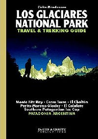
Argentina's Los Glaciares National Park is a world heritage site and offers something for almost everybody but is especially attractive to climbers and mountaineers. This guidebook contains all you need to plan your trip and includes details about:
- El Chalten & El Calafate town guides
- Day trips to the Perito Moreno Glacier
- 16 treks below Mount Fitz Roy and Cerro Torre
- Trek / traverse the Southern Patagonian Ice Cap
- 192 pages, with over 40 photographs.
- ISBN 10: 9872302502
- ISBN 13: 9789872302504
- Publisher: Zagier and Urruty
- Published Date: Nov 2006
- Cover: paperback
- Illustrations: black and white photos
- Weight: 240 gms.
- Price: £15.95
BUY at www.cordee.co.uk and www.amazon.co.uk/Glaciares-National-Travel-Trekking-Guide
Below is a film of climbing Cerro Torre by the Italian alpinist, Ermanno Salvaterra.
FURTHER RESOURCES
More details at www.colinhenderson.co.uk
More photographs at www.flickr.com/photos/chenderson
Los Glaciares National Park website at www.losglaciares.com
Los Glaciares National Park at Summitpost.com www.summitpost.org
Comments