If you get properly midged while cycling to the hills you know you're in for an interesting weekend. The post-work drive from Edinburgh had got us to Glen Strathfarrar in the Highlands due west of Inverness on cue with the evening swarm – and for full effect we'd picked a muggy, windless evening in mid August. Around every bend dense insect clouds hung in the still air, sticking in their thousands to sweaty skin and feeding freely. Counter to the received wisdom movement, even at cycling pace, brought little respite. Gliding through the winged nebulae was like the star spangled warp speed sequence from a space film, and despite the lengthening shadows I stuck on a pair of shades to shield my eyes from midge impacts. When Patrick had to stop to fiddle with a squidgy tyre we were sitting ducks.
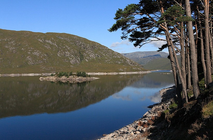
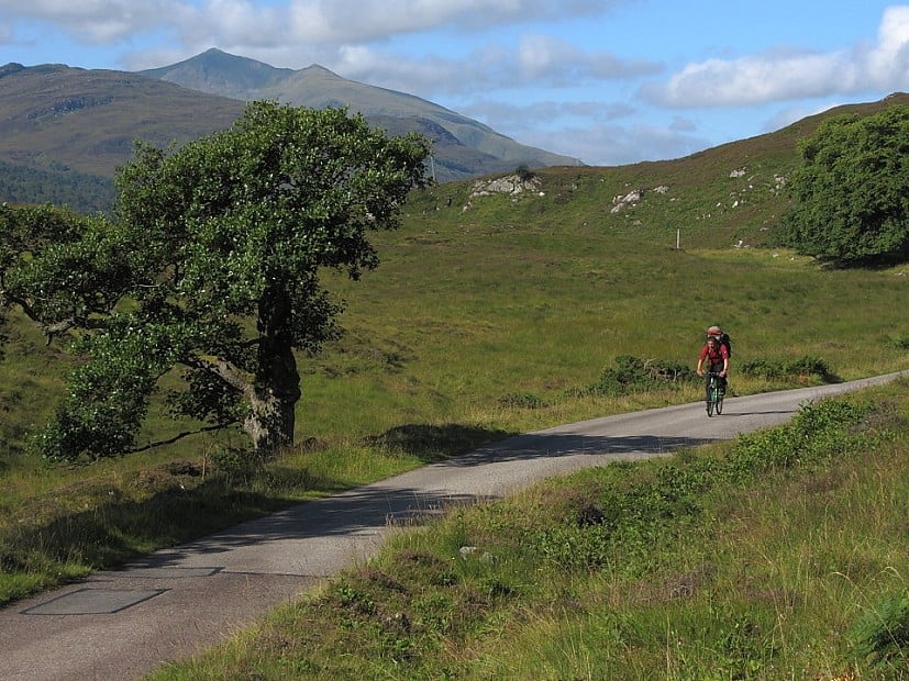
But skin crawling torture aside it was gorgeous. The Glen Strathfarrar road is privately owned, and once the entrance gate is locked in the evening there's no traffic. This meant 26km of car-free single track tarmac, twisting through lush summer woods and meadows, past mirror-calm lochs and big hills glowing gently in the dying sunset. We locked the bikes at the Loch Monar dam and stumbled around in the gloaming, pitching the tent by the shore. Once zipped in we were surrounded, the light rain-like patter of countless midges on the walls hinting at the horrors outside. They kept it up happily all night; perhaps working in shifts.
'This is the dark heart of the Highlands, Scotland's nearest equivalent to a genuine middle of nowhere'
The plan had been a two-day backpack with a mid-way camp somewhere up in the hills, but come morning we just couldn't face the sustained midge assault that de-pitching would entail. We stayed zipped in for breakfast and a brew, then left tent and contents standing and ran. The proposed two day-er might just have to be done in one. I'd set my heart on a full circuit of Loch Monar, 40-odd kilometres via five Munros, a Corbett and a lot of bogs. We'd have our work cut out for us, but given benign weather it had a certain epic appeal. Patrick was in training for a climbing trip to Kyrgyzstan (or Kazakhstan, or one of the 'Stans), so easily persuaded.
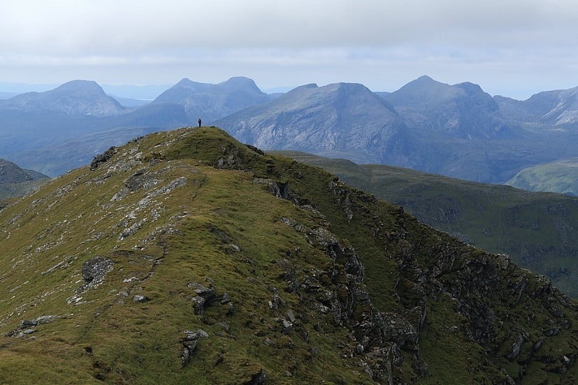
Hemmed between rocky bluffs, the eastern end of Loch Monar has the feel of a sea loch, and beyond Monar Lodge a view opens along its lonely length to the tangle of wild hills that ring its far head. Our route would take us over the lot, and smudged behind low cloud on a sticky morning of undersea gloom they looked distant enough. The mysterious Monar peaks are not easily reached from any angle, famously including some of the least accessible of the Munros. This is the dark heart of the Highlands, Scotland's nearest equivalent to a genuine middle of nowhere, a great emptiness between glens Affric and Carron that sprawls across an entire OS Landranger map, road-free and almost uninhabited. Big burly hills linked by ridges into complex multi-peaked ranges; cold windswept lochs and long low glens where deer vastly outnumber people – you could lose (or perhaps find) yourself for days in here without meeting a soul.
'I didn't volunteer to help - he needed the training'
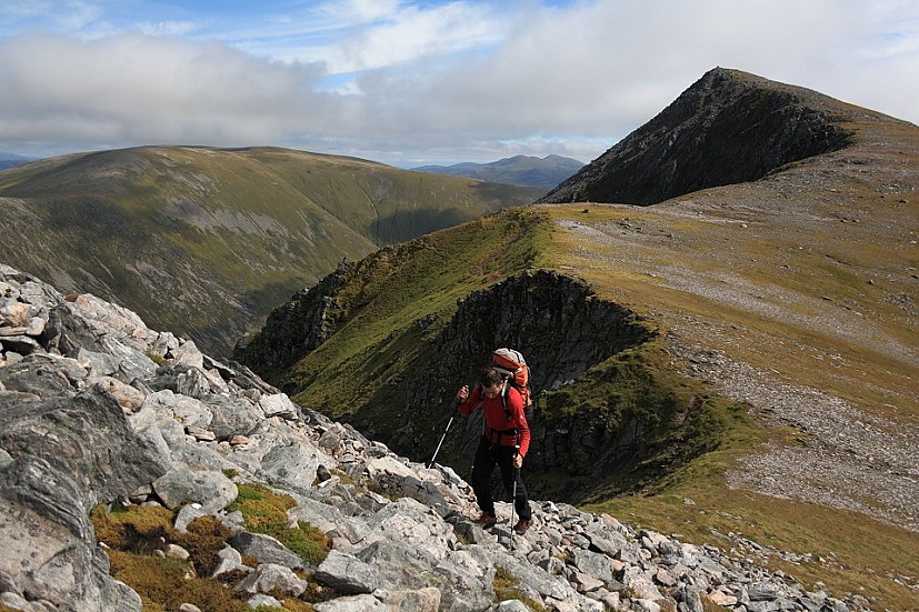
Our first Munro, crag("Maoile Lunndaidh") ?>, was wrapped in a thick mist duvet, but there's a long descent and climb between this and hill two, crag(12974) /*Sgurr a'Chaorachain*/ ?>, plenty of time for the day to switch from dull to scorcher. Patrick was breaking in a pair of mountain boots, but in this heat they soon found their way into his bag. With a load like that he might as well have been carting a tent around after all. I didn't volunteer to help - he needed the training. Sgurr a' Chaorachain is nice and its neighbour crag("Sgurr Choinnich") ?> even more so, a narrow steep-pitched crest like the roof of a giant church. Beyond intervening hills the Coulin and Torridon peaks were emerging from the haze, each a unique individual. Running between the Coulin Forest and the dark heart, Glen Carron is a symbolic border dividing the ordered ranks of the West Highlands from the geological freak show of the far northwest.
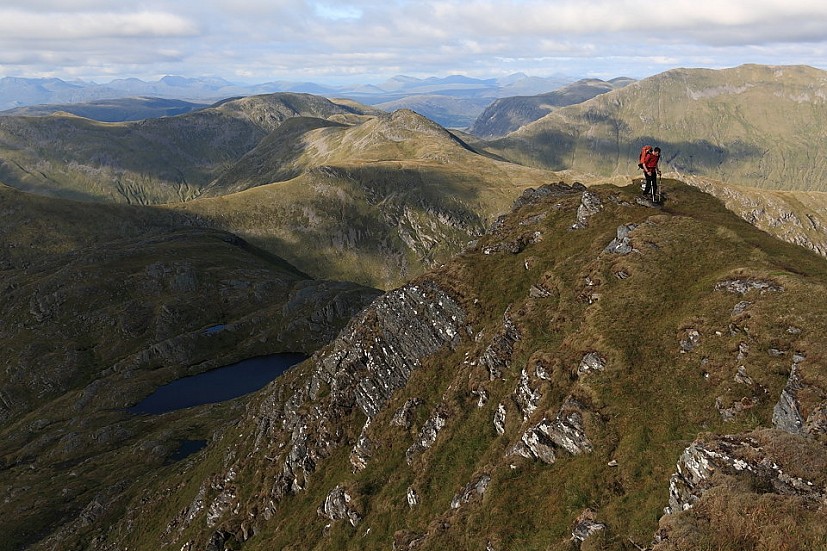
Beinn Tharsuinn was next, and somehow the slide from early morning to afternoon had occurred unnoticed. This is just a wee Corbett, but hefty drops divide it clearly from its bigger neighbours. We found its many summits surprisingly hard going. Sunshine and sustained effort were starting to sap our oomph yet we'd only reached the halfway point. Someone had left a small yellow tent on the close-cropped grass beside an idyllic high lochan, pitched to catch any available midge-beating breeze. Now why didn't we think of that?
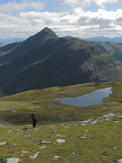
© Dan Bailey |
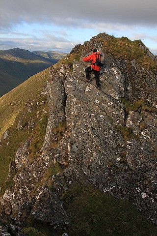
© Dan Bailey |
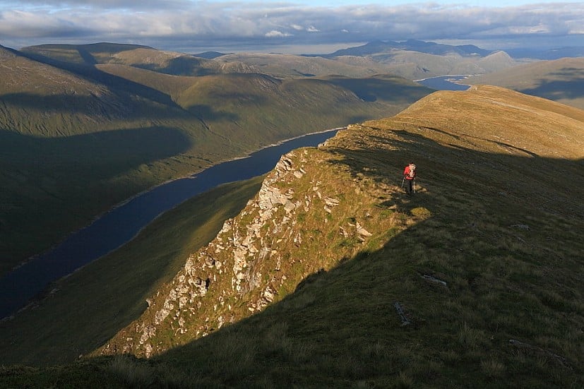
'Sunshine and sustained effort were starting to sap our oomph yet we'd only reached the halfway point. I was having my doubts, but it seemed a bit late for second thoughts'
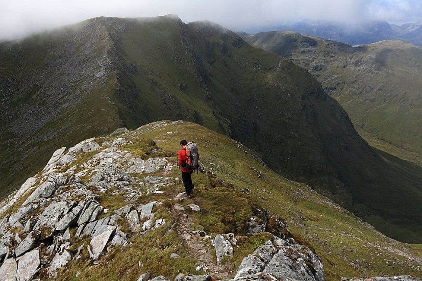
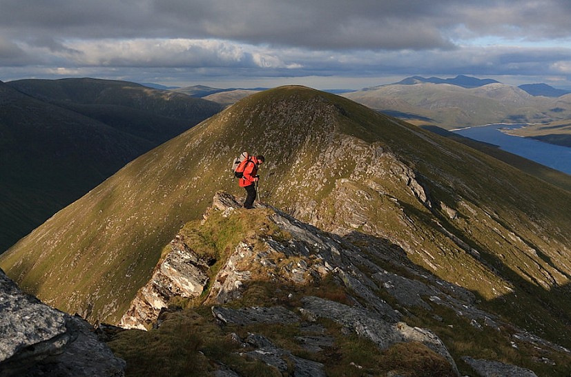
Beyond yet another major col loomed , access to its sharp peak seemingly barred by an intermediate buttress seamed with steep tiers of crag. A sneaky path weaves through the cliffs to give an exciting but practically hands-free route; it'd be a tricky spot in darkness or mist. Cheesecake is a brilliant summit, and really feels miles from anywhere. By now we were definitely slowing; I was beginning to have my doubts about the wisdom of the entire enterprise, but it seemed a bit late to voice second thoughts. As shadows stretched we plodded up , the round's final and finest hill. Continuing east from its flat grassy top the land suddenly pinches tight to form a narrow arête hanging high over the head of Loch Monar, the shelving crest breaking into a series of little rocky teeth. It's a stunning position, but the scrambling is sadly short lived – probably no bad thing at this stage in the game. A gentler grassy ridge-top descent then led us off the hill in fine style, though I may have been nearly past caring. The end was now practically in sight, but still mind numbingly distant; nightfall was going to arrive a lot sooner.
The last light fizzled as we picked across bogs to the lonely loch shore house of Pait Lodge. I hadn't expected occupants, but there they were in their Burberry shirts and loafers, inhabitants of another world and oddly incongruous in that wild, peat-besieged place. Or perhaps it was we who were out of place with our sweat, mud and hypoglycaemia. The aliens proved friendly, and though they couldn't be persuaded to sail us back down-loch after dark we left with a bonus can of lager apiece to dull the aches. There's a lot of trackless bog and thankless track between Pait Lodge and the Monar Dam, and it went in a bit of a daze. I'm not sure we talked much once the beer rush had worn off. Reaching the tent about 1am we just zipped up and crashed, too tired to cook. We may have missed out on dinner, but so did the midges.
For a detailed route description see this UKH Route Card
- Terrain Tarmac, tracks, stalker's paths, pathless bogs and stony ridges. The scrambly ascent of Bidein a'Choire Sheasgaich requires canny route finding, while the traverse of Lurg Mhor's crest is an exciting scramble (grade 1 / 2).
- Distance 44km walk plus 52km cycle to/from Loch Monar dam
- Ascent 3000m-odd on foot, plus a bit on the bike
- Time Walk: 16-20 hours; Run: do you feel lucky?
- Start / finish Cyclists should park at the end of the public road in Struy (NH395405). Walk begins at the Loch Monar dam (NH203394); if the two-way cycle in Glen Strathfarrar looks a tall order in conjunction with the one-day walk consider a pre-hike camp somewhere here.
- Maps OS Landranger (1:50000) 25; OS Explorer (1:25000) 429 & 430
- Pedal power Vehicle access to Glen Strathfarrar is currently restricted to certain times of year and days of the week. There is no overnight parking – an issue on this very long walk. If you can't cadge a lift to the Monar dam you'll have to cycle the glen's 26km private road. On the plus side it's tarmac all the way, there are no nasty inclines, and the surroundings are stunning.
- Guidebook Great Mountain Days in Scotland by Dan Bailey, pb. Cicerone
- INTERVIEW: Exmoor Coast Traverse - England's Best Kept Mountaineering Secret 10 Apr
- REVIEW: Rab Muon 50L Pack 9 Apr
- REVIEW: Boreal Saurus 2.0 22 Mar
- REVIEW: The Cairngorms & North-East Scotland 1 Mar
- REVIEW: Mountain Equipment Switch Pro Hooded Jacket and Switch Trousers 19 Feb
- Classic Winter - East Ridge of Beinn a' Chaorainn 12 Feb
- REVIEW: Salewa Ortles Ascent Mid GTX Boots 18 Jan
- REVIEW: Patagonia Super Free Alpine Jacket 7 Jan
- REVIEW: Deuter Fox - A Proper Trekking Pack For Kids 27 Dec, 2023
- My Favourite Map: Lochs, Rocks, and a Bad Bog 27 Nov, 2023



Comments