
LLooking for a winter sunshine walking destination? Then how about exploring the mountains of Southern Catalunya? The following walk is an extract from Cicerone's guidebook Mountain Walking in Southern Catalunya, which describes 30 idyllic routes for walkers of all experience and abilities.
More information about this Cicerone Guide.
This relatively unknown walking area is in Tarragona, the most southerly province of Catalunya. It includes the highest part of an extensive mountain region that extends over the border into the province of Valencia to the south and up to the city of Tarragona in the north.
Its location makes it an idyllic winter sunshine walking destination from October right through to May. The immense limestone crags, ridges and pinnacles of this region overlook broad orange and olive groves and well-established walking paths. Plus, it's easily accessible – Reus airport is less than an hour's drive and Barcelona is only about 2 hour's drive away.
There's some great local cuisine on offer - Citrus fruits, cherries, almonds and olives from the river plain, rice seafood, cured ham, sausages and game from the mountains, and of course a bewildering array of fish are all on offer. Perfect after a day's walking in the mountains.
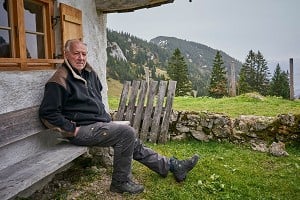
Tortosa makes a good central base for all of the walking areas covered in the Cicerone guidebook Mountain Walking in Southern Catalunya. Its historic centre, full of medieval and renaissance buildings is fascinating to wander around and its market hall is full of local produce and has lively tapas bars.
So book your flight and enjoy the sunshine...

Total ascent 900m
Time 4hrs 30mins (plus 25mins for the summit detour to Punta de l'Aigua)
Distance 13km
Start Paüls
Map El Port Nord, Editorial Piolet, 1:30,000
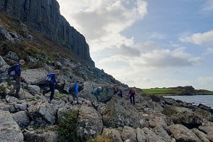
This circular route starts in the picturesque hill village of Paüls. Clear, mostly waymarked, paths lead through the rich and varied terrain from olive and cherry terraces, up through a complex area of overhanging cliffs and steep valleys and onto the open grassy pasture of the Montsagre.
Leave the Plaça Major on the steep street by the right side of the town hall which, after a few minutes, reaches the cemetery. Take the road to the right of the cemetery. At the back of the cemetery the road forks again. This junction has a handsome metal signpost, a local feature which appears in the most unexpected places. Following signs for Montsagre d'Horta and Coll Gilaberta, take the right fork and stay with the main track, leaving the village by the side of olive and cherry plantations.
After 10mins the routes divide at a junction with a second metal signpost. Take the right track (GR171) and after approximately 50m, turn left onto a path (clear red and white marker).
Very soon another track is joined. Turn right and descend for 50m, leading to a junction (cairn and red and white marker). Turn left onto a path which descends into the valley on zigzags. Cross a small stream at the bottom of the valley on stepping stones.
The route now ascends to join a track; follow it to the right for a few minutes to reach a wire fence. Leave the track by turning left onto a red and white waymarked path and climb beyond the village fields to enter an increasingly wild region of steep valleys and cliffs some 10mins later.

© Cicerone, Phil & Vivien Freakley
The path enters a cirque with dramatically overhanging cliffs and passes a shallow cave where, after wet weather, a waterfall tumbles through a hole in the roof. The path exits the cirque through large boulders and then climbs, steeply in places, zigzagging through pine and oak woodland. The path enters a valley and descends slightly, to converge with and cross a stream bed. A few minutes further on upstream it crosses back, where the continuation is only marked by a cairn. There are two further crossings. The path now rises on the left side of the valley to emerge onto an unexpectedly lush and grassy area and continues alongside a stream for a few minutes, reaching the Font del Montsagre de Paüls.
Turning left onto PR-C9, yellow and white markers lead along a high grassy valley. The path rises gently and then crosses some inclined limestone pavement to reach a wood. Just before entering the denser woodland there is a Reserva Nacional de Caça sign on a tree and, facing it, a cairn and yellow and white marker. Turn left here and then right after 20m to enter the wood on a clear path. Leaving the trees, the path rises gently onto a high escarpment overlooking the Aragon plain, with the town of Horta de Sant Joan and the rounded rocky tops of the Muntanya Santa Barbara in the middle distance.
The path then drops to the Font del Montsagre d'Horta in a small valley headed by cliffs. Here another signpost points the way on to the Coll de la Gilaberta. After 10mins or so the path veers left, away from the line of the Montsagre d'Horta escarpment, following the yellow and white markers up and over a small rock band to reach the Coll d'Atans. The 360° panorama from the Coll d'Atans reveals the drama of els Ports: below, the wooded Coll de la Gilaberta, ahead the steep rock of the Punta de l'Aigua. The path now descends left over rocks to the Coll de la Gilaberta. Here a metal signpost points directly onwards to Vacarissal.
 © Cicerone, Phil & Vivien Freakley
Two paths start in this direction and either can be used as they join later, although the left-hand path is favoured with cairns and yellow and white waymarks. About 10mins from the junction the now single path rises diagonally across steep rocky terrain towards a clear notch in the skyline. At the col there is a yellow and white marker and old directions in red paint, including one for the summit of the Punta de l'Aigua.
To visit the summit the route starts with a scramble up the ridge for about 50m, when it is possible to move to the right and gain a path leading up steeply into woodland. This rises, after 10mins, to a dip in the summit ridge. A path to the left leads to the highest point of the Punta de l'Aigua while to the right there is a remarkable airy ridge from which it is possible to look down 750m onto the village of Paüls.
After returning from the summit by the same route, the path continues straight on, descending steeply over rocks and stony ground. After about 12mins from the col the path rises to cross a subsidiary ridge of the Punta and then descends more gently. The path leads to Vacarissal. In this small, grassy valley there is a junction of paths and another signpost.
Starting in the direction signposted Paüls, the path rises through a small valley to reach a junction where the route turns left, abandoning the PR-C9 and its yellow and white markers. The new path continues to rise, guided by cairns, up to the Coll d'Avenc. Turn left along the top of the escarpment here, until the path starts to descend after about 50m. This excellent path descends gently to the left through pine woods and then by a series of zigzags down to a T-junction some 15mins after leaving Vacarissal. Turn left and continue for 30mins when the path converges with a track and in a little while passes a restored mas (farm). The track ends at a junction with a concrete and asphalt road after a futher 8mins; turn left along this road to reach the cemetery above Paüls after about 20mins to complete the circuit.


Comments