
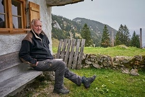
The following route is an extract from Cicerone's 'Scotland's Best Small Mountains' by Kirstie Shirra. The guide champions some of the smaller peaks, selected for their character, locations, views and sheer beauty.
Distance: 14km
Time: 5hr 30
Ascent: 820m
Difficulty: A good walk in on tracks gives way to grassy slopes that are less challenging or steep than the rocky peaks of Ben Loyal might suggest.
Maps: OS Landranger 10, OS Explorer 447
Access: Ben Loyal forms part of the Ben Loyal Estate (01847 611291)
Getting there: Start at the turning to Ribigill Farm off the minor road around the Kyle of Tongue (584 546). There is parking for a couple of cars. You could walk to here from Tongue. There is a daily bus from Thurso to Tongue.
Something else to do: Take a walk on the stunning sands of the Kyle of Tongue, or visit the ruins of Varrich Castle, once home to the MacKay clan chiefs.
More information about the Cicerone Guide:
Scotland's Best Small Mountains
Ben Loyal (765m)
Ben Loyal is a royal hill on the northwestern tip of the Scottish Highlands, renowned for its queens, castles and treasure. Climbing far above the Kyle of Tongue, this route gives you an opportunity to conquer your own castle, and gaze out to where the North Sea meets the Atlantic Ocean.
The granite tower of An Caisteal, 'the castle', is Ben Loyal's highest top, at 765m. It is just one of the five rocky tops that crown the ridge, causing it to be described as castellated. From each of these tops you gain fantastic panoramic views over the surrounding countryside, composed as it is of vast swathes of wild land and water. The shifting white sands of the Kyle of Tongue in particular are a sight to be seen.
The Route
From the start, follow the road to Ribigill farm, going left where it divides to pass between the farm buildings. Continue along the track from here, which runs between the fields heading towards Ben Loyal. Ignore a fork off to the right to head left and across a small ford. This track takes you across level boggy ground towards the ruined farm of Cunside.

© Cicerone & Kirstie Shirra
Cross the Allt Lon Malmsgaig (580 515) to the same side as Cunside, but then leave the track to take a small path heading south-southeast towards the Bealach Clais nan Ceap. This climbs up the right-hand side of a small burn.
Leave the path before you reach the bealach to climb steeply southwest up the side of Sgor Chaonasaid at the end of the Ben Loyal ridge, gaining the summit of Sgor Chaonasaid (712m) from the south. From here there are fantastic views of the ever-changing sand banks in the Kyle of Tongue.
Follow the grassy ridge from Sgor Chaonasaid to pass over Sgor a'Bhatain (708m) and come to the rocky summit of An Caisteal. This seemingly impenetrable mass of rock is in fact easily gained by heading to its west side from where a small path takes you to the summit (765m) (578 488, 7.5km, 3hr). All other routes would involve a serious rock climb. From its elevated position, this rocky castle offers brilliant 360º views.

© Cicerone & Kirstie Shirra
To return, retrace your steps to the shoulder between An Caisteal and Sgor a'Bhatain, then head east down gentle slopes towards Loch na Creige Riabhaich. Just north of the loch you can pick up a path that runs north-northeast across the broad plateau, then zigzags down more steeply to rejoin the original path into the Bealach Clais nan Ceap. Follow this to return to the start via the outward route (14km, 5hr30).
Alternatives
For a full traverse of the ridge, return to the west side of the summit of An Caisteal, then go south along the ridge to Beinn Bheag (744m). Carry on south taking you down then back up to the top of Carn an Tionail (716m), the last top of the ridge. From here, head west down grass and heather slopes to come to the top of a gully. Follow the gully down to meet the Allt Fhionnaich and head down its left bank, crossing it before it enters a steeper gorge (564 476).
Head north then northwest around Sgor Fhionnaich before following a second burn steeply down through the birch forest to level ground below. Continue northwest across rough grassland to rejoin the path just before Cunside (20km, 960m).


Comments