
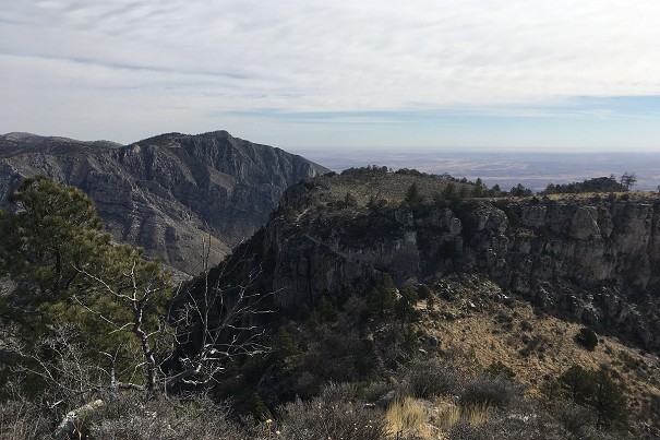
Destination Hillwalking in Wild West Texas
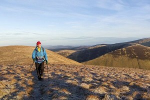
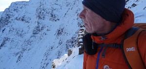
In Spring 2022, Munroist Ian Robertson went to the desert hills of west Texas in search of something a bit different, and ended up having one of the best trips of his 30-year hillwalking career.
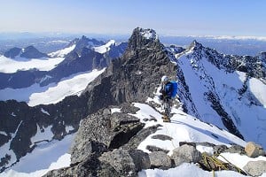
In two weeks of mountain travel you will be witness to the greatest collection of 4000m peaks in all the Alps and visit some of the most spectacular valleys. There you'll find delightful villages and remote alp hamlets, wander flower meadows and deep fragrant forests, skirt exquisite tarns that toss mountains on their heads, cross icy streams and clamber beside glaciers that hang suspended from huge buttresses of rock. You'll traverse lonely passes and descend into wild, stone-filled corries. There will be marmots among the boulders and ibex on the heights. And your days will be filled with wonder.
It's more demanding than the well-known Tour du Mont Blanc, for the route is over 180km long; it crosses eleven passes, gains more than 12,000m in height and loses more than 10,000m. But each pass gained is a window onto a world of stunning beauty.
A full day out walk excerpt from:
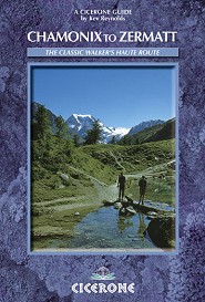
Chamonix to Zermatt - The Classic Walker's Haute Route
By Kev Reynolds
Published by Cicerone
Stage 2:
Agentiere - Col de Balme - Trient
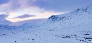
For a first full day's walking this is a convenient and relatively undemanding stage, views are dominated by Mont Blanc and its aiguilles, and the valley of Trient into which you descend is green and pastoral.
Distance: 12km
Time: 5–51⁄2hrs
Start altitude: 1251m
High point: Col de Balme, 2204m
Height gain: 953m
Height loss: 925m
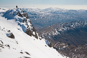
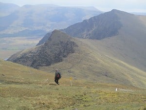
 © Cicerone & Kev Reynolds
 © Cicerone & Kev Reynolds
 © Cicerone & Kev Reynolds
The Route
From the centre of Argentière take the road to the right (east), to pass the village post office and Office du Tourisme, and cross the river (l'Arve) with the Glacier d'Argentière seen directly ahead. At a junction of streets bear right into the Chemin de la Moraine, and you will come to the line of the Mont Blanc Express railway. Pass beneath this and onto a track going ahead towards woods where you join the Petit Balcon Nord. Shortly after passing a chalet on the right, you'll see another set back on the left. On coming to a second chalet on the left, take the path beside it which joins the main Petit Balcon Nord at a signed junction. Turn left towards Le Tour.
Rising steadily among trees you will come to a path junction (30mins) where you continue straight ahead. In another 10mins there's a second junction where again you keep ahead. Emerging from the woods the path narrows and gradually loses height with the village of Le Tour seen below. Cross a stream draining the Glacier du Tour and walk on into Le Tour.
If you prefer to take the easy way to Col de Balme, ride the gondola lift to Charamillon, then take the chairlift to Les Grandes Otanes, from which a short contouring path leads to the col. Walk to the roadhead by the Télécabin Le Tour Col de Balme.
The main path to Col de Balme passes along the right-hand side of the gondola lift station, and continues ahead on a broad track/ski piste. About 5mins from the gondola station a signed path strikes ahead to the right and twists up to the middle station of the gondola lift.
Above Charamillon a path branches to the right away from the main track on the way to the popular Albert Premier refuge, first passing the Gîte d'Alpage (20 places, open mid-June to mid-September (Tel: 04 50 54 17 07), refreshments). Ignore this option and maintain direction; when the track forks by a ski tow continue ahead, but 2mins later take a steep path which rises above the track. The gradient soon eases and the path gains height without undue effort to reach the Chalet-Refuge Col de Balme.
The col makes a wonderful viewpoint. To the south stands the snowy mass of Mont Blanc and its guardian aiguilles – Aiguille Verte and Drus being predominant in that view, while the Aiguilles Rouges line the right-hand wall of the valley.
Veer left beyond the refuge to a signpost at a footpath junction, then branch right to begin the descent. Trient is 2hrs from the col. The path goes down in long loops at first (a water supply at the hut of Les Herbagères), but once you enter forest the way steepens with tighter zig-zags. It brings you into a rough pastureland where you bear left to cross the Nant Noir stream and walk down to Le Peuty. Continue down the road for a further 10mins to the village of Trient.
In Spring 2022, Munroist Ian Robertson went to the desert hills of west Texas in search of something a bit different, and ended up having one of the best trips of his 30-year hillwalking career.

Daft online reviews occasionally make it into the mainstream media, and they don't get much sillier than complaints about mountains. Since we're not above laughing at the less hill-savvy, we've mined Tripadvisor for some...


Comments