


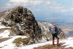
What's the one really big impact that human beings have made on our hills? Is it the erosion of the footpaths? Is it the lead and copper mines and their poisoned spoil heaps? Is it the wind farms sprouting like metal toadstools? The one big change goes back further than any of those, and is more far-reaching. So far-reaching, indeed, that you may not have noticed it...
 © Ronald Turnbull
The great pine forests of Scotland were sometimes burnt down wholesale to destroy the habitat exploited by wolves and human bandits. The charcoal-burning industry, to fuel early furnaces that smelted iron, consumed most of the oakwoods of the southern Highlands. Shipbuilding during the Napoleonic Wars took oak for the bent timbers of ships' hulls, and pine for their masts. And once the trees were cleared, grazing by sheep or red deer, destroying any small saplings, kept – and keeps – the ground as grass and heather. The way to see this tree-clearance is to spot where it hasn't happened. In the Cairngorms, tree growth is being encouraged to recover up to the natural treeline at about 800m. Elsewhere, glance into any gully where the sheep and deer can't wander. At any level below the very summits, you'll see trees thriving.
With the clearing of the ground came the first folk to actually inhabit the hilltops – who also happen to be the last. Iron Age hill forts were, in many cases, permanent settlements. The one on the Eildon Hills has scores of hut circles inside it; Cadbury Castle, in Somerset, held large timber halls, and is as good a candidate as there is for being King Arthur's Camelot. Some hill forts have visible field systems on the high ground alongside. With the valleys waterlogged and covered in alder scrub, this may have been the best farmland. Few hill forts are in true mountain ground: presumably it was simpler, when attacked, to retreat into the high corries. They are common along the Highland line, on the Scottish side of the Cheviots, and in Somerset – which may just be because they're all places rich in the right sort of small, steep-sided hill.
With the clearing of the ground came the first folk to actually inhabit the hilltops – who also happen to be the last. Iron Age hill forts were, in many cases, permanent settlements.
No humans since have chosen to live so high. Instead, from the Stone Age clearances onwards, winter saw livestock down in the valleys, enclosed indoors – or, most convenient of all, killed, smoke-dried, or salted down. Summer saw half the village moving uphill to the high corries. Cattle, sheep and goats grazed the summer grasses, while down in the valley crops could grow untrampled. This yoyo lifestyle is called transhumance; practised today in parts of the Himalaya. All over the Highlands, corries around the 500m level have remains of summer shelters called shielings. Often these were low stone walls, which would be completed each year with roofs of heather turf. Here young people would spend the summer making cheese and butter, and presumably also music, not to mention love.

© Ronald Turnball

© Ronald Turnbull
A few fallen walls, a green fertile patch, commemorate the live communities that were driven out, to colonise Canada, Australia, New Zealand and the USA. But otherwise, the evidence of the Clearances is like those absent trees – you see what isn't there.
From 1745, and the brutal quelling of the Jacobite rebellion, the lands of the Highlands were cleared. Clan chieftains became landlords – landlords who found that it better paid for their new London lifestyles to have their land under not people, but sheep. A few fallen walls, a green fertile patch, commemorate the live communities that were driven out, to colonise Canada, Australia, New Zealand and the USA. But otherwise, the evidence of the Clearances is like those absent trees – you see what isn't there.
Throughout the Scottish Highlands, the glens are as bleak and empty as the high infertile moorlands and hill slopes. The single-track road runs through heather and peat bog, rank growth on watersodden ground that was once so carefully drained and cherished. There's an illusion that such bleakness is the natural way of things – until you travel to Ireland, or the Lake District, or the Yorkshire Dales. And then you see valleys as they should be, patchworked with tiny fertile fields, with small stone houses matching the rough-built walls of the farmland. The oldest of those walls – such as the fell wall running around Great Langdale – go back to the late Middle Ages, when the monasteries brought advanced farming. The building of dry stone walls, right up across the fell lines, marks the slow work of farming craftsmen: perhaps a single lonely worker, making two or three miles of walling in a summer, with small hammer, crowbar and barrow. Alongside many walls, look out for the small 'borrow pits', where stones were quarried alongside the line of the wall. Today, they make sheltered spots for lunch.

© Ronald Turnbull
In much of mid-Wales, while there were not the ruthless clearances of the Scottish Highlands, a similar effect came from simple poverty, in particular in the famine year of 1845 when potato blight destroyed the main food source of small landholdings. In the Southern Uplands of Scotland, however, the silence of the valleys goes back rather further. The 15th and 16th centuries saw a breakdown of the rule of law, and a tribal lifestyle of raid-your-neighbour. Exciting and romantic in the Border Ballads collected by Sir Walter Scott for those who lived through it, it meant insecurity and famine. Indeed, those who lived through it more commonly didn't: dying in the blood feuds that replaced more civilised systems of justice, or starving at midwinter after an autumn raid had taken livestock and burnt the fields. Again, all you see now is what's no longer there: glens almost empty, and the occasional fortified tower or small castle. One such pele tower even stands in Kentmere among the Lakeland fells.
 © Ronald Turnbull
Perfect for the purpose was the gritstone laid down in river deltas of 300 million years ago. And so, on the Millstone Grit of the Peak District, and similar stone of the North Yorkshire Moors, millstones were quarried on the high fells, and rough-hewn (to save weight) before being wheeled or sledded down to the valleys.
Apart from grass, the main product of the high fells is stone. But stone is easy to find, and difficult to shift; so it's normally quarried close to home. Summit stone was gathered for the Langdale axes; but with the Stone Age over, only a single motive sent specialised stoneworkers onto the fell tops. Mills for grinding flour require a special sort of stone: one that consists of sharp crystals held in a softer matrix. Then, as the stone wears away, new sharp crystals are constantly exposed. Perfect for the purpose was the gritstone laid down in river deltas of 300 million years ago. And so, on the Millstone Grit of the Peak District, and similar stone of the North Yorkshire Moors, millstones were quarried on the high fells, and rough-hewn (to save weight) before being wheeled or sledded down to the valleys. An economic downturn might mean a sudden stop to such quarrying, and millstones left lying along the crag foot.
The Industrial Revolution cleared oakwoods for the smelters: but also called for urban housing for the English Midlands and the growing cities. Clay for bricks was close at hand, but for roofs they needed slates. Slaty cleavage is a result of compression:lates are squashed rocks. They come out of the roots of the mountain ranges of the Scotland-England collision: the old, metamorphic rocks that now make Snowdonia, Lakeland, and Glen Coe. Usable roof slates come from rocks that, before being squashed, were smooth and uniform, the best being former volcanic ash. Where they found such stone, the quarrymen dug deep into the hill: at Llanberis, Coniston, Honister and Ballachulish.
The same mountain-building that squashed the slates, also caused volcanoes – it's a matter of plate tectonics, a continental crust being shoved over a descending ocean bed. The underground friction between the two plates melts the magma and sends it oozing up towards the surface. When a great granite lump rises underground, it heats and cooks the overlying rocks. Quartz and superheated steam surge upwards through the cracks: and in that quartz, metals are dissolved. And so the same old mountain roots of Snowdonia and Lakeland that in some places yield slates, in other places reveal veins of lead and copper, silver, and stranger metals too.
Keswick, in the time of the Lakes poets, was a industrial scene. Smelters were on the islands of Derwent Water. Mine spoil and noisy millwheels were under Cat Bells. Black smoke drifted across the water.
Britain's hills were mined in Roman times: tin in Cornwall, lead and possibly copper in the Lakes. Old mines are enlarged into later ones, and no signs of the really early miners remain. But in the Pennines in particular, the gravelly platforms around 18th-century lead mines are still bare, as the lead salts poison the surrounding ground. In Lakeland's northern fells, look out for bare shaley areas, low remains of buildings, and – the real giveaway – the contour-following lines of former leats, artificial streams bringing the water to power the crushers and smelters. Keswick, in the time of the Lakes poets, was a industrial scene. Smelters were on the islands of Derwent Water. Mine spoil and noisy millwheels were under Cat Bells. Black smoke drifted across the water, and across the chimney pots of the impoverished mine cottages that today are desirable B&Bs and holiday cottages.

© Ronald Turnbull
When growing cities needed clean water, modern-minded hill folk looked to the fine new dam of Thirlmere, whose concrete would set off so admirably the rockfaces of Raven Crag.
Today we find such industrial scenes romantic – provided they're old enough, and in ruins. But Lakeland visitors of the early 1800s were thrilled at all the human activity and wealth creation. And that attitude even extended into the 20th Century. When the growing cities needed clean water, modern-minded hill folk looked to the fine new dam of Thirlmere, whose concrete would set off so admirably the rockfaces of Raven Crag.
And in the 1950s, there were those for whom the pylons striding across the hillsides were magnificent expressions of the white-hot technological revolution. They were, after all, designed by Gilbert Scott, of Liverpool Cathedral, Battersea Power Station, and the elegant red phone box; and named from the massive temple buildings of Egypt. Indeed, for a mere £15 you can join, today, the Pylon Appreciation Society [www.pylons.org]. And environmentalists are often so overwhelmed by the need to combat climate change that their eyeballs register windfarms as noble, handsome structures liable to enhance tourism.

© Ronald Turnbull
The reservoirs of the last 60 years spread their vast concrete dams across whole valleys. But it's the fluctuating lake shoreline, surrounded by bare yellow mud and stones, that shows up most from the hillsides above. The reservoirs of mid-Wales, like Thirlmere, Cow Green and Keilder, were built for water supply. But it was to supply hydro-electricity that most of Scotland's lochs were impounded and converted to rubble-edged reservoirs. Loch Lomond and Loch Ness, only a few metres above the sea, were both spared. Almost every other Scottish loch is now a reservoir, with added pylons and loss of loveliness. Due to her hydro-electricity, Scotland emits less carbon. But this does not come without damage to our mountain landscape. We must do everything we can against the damage we have caused and are causing to the world's climate. This surely includes wind farms. Even so, I refuse to see them as either attractive or handsome.
"...When it comes to inserting ugliness, though, no age yet has matched our own..."
But perhaps to hill visitors in two centuries' time their mossed and gothic remnants will appear as charming relics. What will industrial archaeologists make of the hill junk of our own age: the civil aviation authority's radar domes, the mobile phone masts, the majestic radio towers of Caldbeck, the hundreds of gnomelike trig points? Since the Stone Age, the hill scene has been moulded by man. When it comes to inserting ugliness, though, no age yet has matched our own.

© Ronald Turnbull
About Ronald Turnbull
"I'm an all-weather walker, writer and photographer based in Southern Scotland. My special interest is in multi-day backpack trips over rough country, and I have completed 18 different coast-to-coast journeys across various parts of the UK. I like to sleep out without tent on UK hilltops, and have achieved comfortable nights on more than 40 in Scotland and Cumbria."
More about Ronald on his website: www.ronaldturnbull.co.uk


Comments