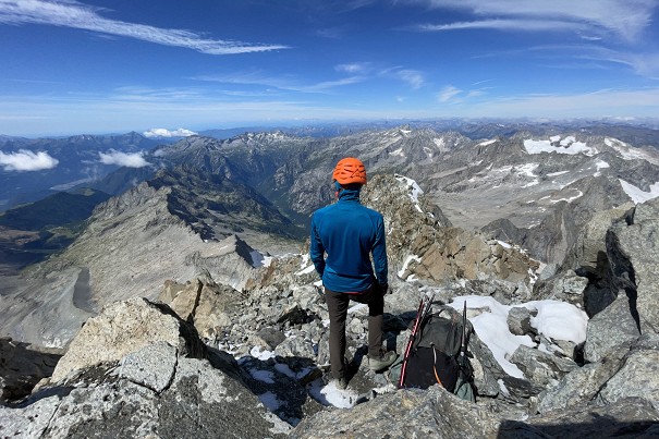
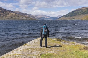
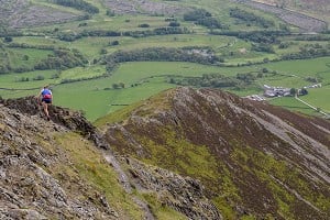
Scottish Wild Country Backpacking - 12 Great Journeys

© David Lintern

From its rugged-but manageable mountains to its progressive access laws, Scotland could have been made with backpackers in mind. The big walks here are world class.

In their new book Scottish Wild Country Backpacking, authors Peter Edwards, David Lintern and Stefan Durkacz explore 30 weekend and multi-day routes across the highlands and islands. We asked them each to nominate a few favourites.

Zig Zag Wanderer – Streap and Braigh nam Uamhachan

This is one of the shortest routes in the book, featuring two Corbetts – one of the tallest, and one of the smallest - that sit next to each other across a glen stuffed full of Shieling remains. In Gaelic, Streap means, simply, "climbing", and for the language buffs, that's a 'Gerund'; a verb that's also a noun. That tells you something about the Gaelic language and Highland life more generally - active, fully engaged with a demanding landscape - as well as something about the hill itself. It's a long, sinuous snake of a ridge with a couple of short airy steps that's relatively low in technicality, but high in solitude and romance … and yet so many choose to visit as an up-and-down, done in a day trip.

The spectacular NE ridge from Streap Comhlaidh. Streap translates from Gaelic as ‘climbing’  © David Lintern
The spectacular NE ridge from Streap Comhlaidh. Streap translates from Gaelic as ‘climbing’
© David Lintern

Streap deserves more than a tick. One of the underlying motivations for route choices in the book was to try to do a bit more justice to some of the topography, rather than just bag summits. Viewed from the air, the full traverse of the hill would create an elegant switchback Z. It adds a bit of challenge to do it in winter, as one of the steps can get banked out. Its lower lying partner gives great views over Loch Shiel and Streap itself on the return, and there's a bothy at the start and end of the loop for convenience. A short, sharp weekend hit.

David Lintern

Splendid Isolation – The West Coast of Jura

It's the French Alps in miniature, minus the infrastructure, or a Pyrenean Haute Route, but with better views to Torridon

The west coast of Jura is arguably the wildest stretch of coastline in Scotland. There are no roads, permanent habitations or livestock here, just a ruggedly beautiful landscape of glacial cliffs, white sand bays and remarkable geological phenomena – the shores and glens teeming with wildlife. Vast raised pebble beaches, imposing igneous dikes, numerous caves, natural arches and stacks make this a landscape like no other, providing some of the most stimulating and challenging walking Scotland has to offer.

Bracken-infested rocky terrain south of Glendebadel Bay on the north-west coast, Isle of Jura  © Peter Edwards
Bracken-infested rocky terrain south of Glendebadel Bay on the north-west coast, Isle of Jura
© Peter Edwards

The route included in SWCB is a tough four-day, 50km trek taking in the island's entire north-west coast; the terrain is often rough-going, rocky, boggy and largely pathless save for deer and goat tracks. From spring through autumn dense bracken, adders, deer ticks and the island's pathologically aggressive midges add to the fun. In short, it's not a walk for the unfit or faint-hearted.

However, the considerable upsides include three sublimely-situated bothies, excellent bivouacking sites, some of the most austerely beautiful coastal scenery anywhere and unrivalled opportunities for wildlife spotting – often at close quarters.

Peter Edwards

A Small Isles Circumambulation – Around the Coast of Rùm

The dark volcanic peaks of the Rùm Cuillin are undoubtedly the island's focal point for most experienced walkers, although there is a wealth of excellent walking beyond this spectacular mountain ridge. The northern hills around Glen Giurdil including Orval and Bloodstone Hill, together with Kilmory Bay and Harris Bay, provide the other obvious attractions.

Guirdil Bay and the bothy beneath Bloodstone Hill, Isle of Rùm  © Peter Edwards
Guirdil Bay and the bothy beneath Bloodstone Hill, Isle of Rùm
© Peter Edwards

However, for an immersive multi-day backpack, a tour of Rùm's dramatic coastline is hard to beat. Rugged cliffs, rocky shores, magnificent sandy bays and impressive geological features abound. Furthermore, the constantly shifting seascapes together with views across to other Hebridean islands and the mainland mountains are superlative. Wild goats and red deer are plentiful while golden and white-tailed eagles are also present – Rùm saw the first of the successful re-introductions of the latter species in the 1970s.

A complete circumambulation of the coastline of Rùm only amounts to some 40km but three days is a sensible amount of time to allow as the terrain is often pathless and rough going. The route traverses terrain that is at times rugged, boggy, tussocky or cloaked in dense heather, but it is nowhere unmanageable except in the very north-east of the island, which the route included here bypasses in any case. The excellent MBA bothies in Glen Dibidil and at Guirdil Bay (pictured beneath Bloodstone Hill) make for obvious way stations along the route.

Peter Edwards

Ben Alder – Tour of the Ridges

The temptation with a book that aims for some of the quieter places in the Highlands and Islands is to look to the margins, but we were keen to include a few things accessible by rail and within striking distance of the Central Belt. This isn't a compromise, though – here we get a bumper crop of 6 Munros, a line around three of the finest, easier mountaineering ridges in Scotland (consider it a recce for a return winter trip!), and an immersive journey in what is now some very remote-feeling country.

The Bealach Dubh is one of the finest passes in the Central Highlands and a high point on the Thieves Road  © David Lintern
The Bealach Dubh is one of the finest passes in the Central Highlands and a high point on the Thieves Road
© David Lintern

And of course every 'middle of nowhere' is the middle of somewhere in Scotland. This area was once part of a major thoroughfare between east to west. Our route details had to be changed at the eleventh hour to divert from a current access dispute at the entrance to the 'Thieves Road' - the level crossing at the edge of Dalwhinnie - but it remains a historic right of way, traditionally used by cattle rustlers, or 'reivers', to move stolen stock from Badenoch and Strathspey to market at Fort William. After our minor detour at the start, we still get to join and then rejoin those reivers by way of perhaps the finest pass in the central highlands, the Bealach Dubh.

Topographically, the centre of the country packs a lot in, too, and this route tours a beguiling mix of Cairngorm-a-like plateaux and more ruggedly scooped arêtes and corries that are more akin to the terrain out west. It also offers some of the finest and most straightforward wild camping in our wee book, a sea of hill and moor in all directions, and a beginner's grade scramble to spice things up towards the finish. It's a three- day adventure for breathing deep and striding out on.

David Lintern

Across the inland ocean – Blair Atholl to Kingussie

There are two types of exposure to be found in the Scottish mountains. The better known variety can be experienced on the ridges and arêtes of the north and west. The other, subtler kind haunts the vast, rolling plateaux of the Grampians that fill out the long miles between Atholl and Badenoch. Although these hills lack immediate drama, the sheer emptiness and vast horizons can work a slow magic, in a place where the only sounds are the breeze raking the heather and the reedy calls of golden plover.

A view up Gleann Mhairc showing the New Bridge near the former township of Sean Bhaile in Glen Tilt  © David Lintern
A view up Gleann Mhairc showing the New Bridge near the former township of Sean Bhaile in Glen Tilt
© David Lintern

I've long had a fascination with this tract of hill country. It's crossed by some venerable old routes such as Comyn's Road and the Minigaig Path, grand expeditions in themselves. But it's the potential for off-trail crossings that really stirred my imagination. I wanted to trace a route over the high ground that would satisfy both the wanderer and the hill bagger, linking together four disparate Corbetts. One of these especially, Beinn Bhreac, is seriously remote and hard to reach in a day. It's a committing journey that feels rather like an ocean voyage, as you cast off from the security of Glen Tilt and plot your course across the heathery swell towards the distant shores of Strathspey.

It's not all crying emptiness though. Early in the walk you'll pass through the atmospheric township remains of Sean-bhaile, emptied of its folk in the 19th century. Moorland mariners can be amply rewarded with beer and victuals in Blair Atholl and Kingussie at either end. The villages are linked by rail, so cars are optional.

Stefan Durkacz

A tangled tapestry – Inverinate Forest and the Gates of Affric

This route was a while in the making. I spent many hours poring over the map, trying to make sense of the jumbled hinterland between Loch Duich in the west and Affric to the east. Gradually a route emerged, like a coloured thread through a tangle of yarn, stitching together some wild and secretive summits, a trackless river, a mighty waterfall and one of the finest mountain passes in Scotland.

By the Abhainn Gaorsaic in the pathless, empty hinterland between Affric and Kintail  © Stefan Durkacz
By the Abhainn Gaorsaic in the pathless, empty hinterland between Affric and Kintail
© Stefan Durkacz

In keeping with the spirit of the book, I decided to eschew the popular Five Sisters ridge to the south. Instead, this is about variety, challenge and going off-piste. The route arcs across rarely trodden moors linking two solitary Corbetts, a very fine Graham, a brace of Munros and the Falls of Glomach, one of the highest waterfalls in Britain and a dizzying sight from the path scratched along the side of its gorge.

The centrepiece is a traverse of the sprawling massif of Beinn Fhada, but it's the narrow pass between the 'long mountain' and its northern neighbour A'Ghlas-bheinn that encapsulates the essence of this route. The Bealach an Sgàirne or 'Gates of Affric' is the summit of St Duthac's Way, a pilgrimage route of great antiquity between Easter and Wester Ross. The sudden revelation of the Affric mountains ahead is a fine reward and an irresistible invitation to further adventures.

Stefan Durkacz

Where gloomy peaks meet shining seas - The Applecross Peninsula

In geological terms, the mountains of Applecross are closely related to the famous Torridon peaks to the north. The scenery is almost as magnificent – soaring, stepped ridges, massive terraced buttresses and deep, hidden corries. The difference, and partly what led me to consider this area for inclusion in the book, is that these hills are quieter and less well-known than their Torridon cousins, no doubt partly because the summits fall a little short of Munro height.

One of the authors – Stefan – caught in the last rays of sunset after a stiff scramble up Sgùrr a’ Cha  © David Lintern
One of the authors – Stefan – caught in the last rays of sunset after a stiff scramble up Sgùrr a’ Cha
© David Lintern

This is a short route – the Applecross range is pretty compact – but a rough one in places. The first of the two Corbetts, Sgurr a' Chaorachain, requires a brutally steep ascent. The intervening miles to Beinn Bhàn's extensive, grassy plateau are full of bare rock and awkward ledges making for slow progress. That moment when you arrive at at Beinn Bhàn's summit and the sudden gulf of Coire na Poite yawns beneath you is a mighty pay-off, however.

Yes it's a rough route, but it's a romantic one too. Walking the relatively easy terrain north from the top of Beinn Bhàn towards the shining sea and the Outer Hebrides on the edge of sight gives an insight into what makes Applecross unique. It's the peninsula that wishes it was an island, tethered to the mainland and the gloomy peaks behind but forever straining for the open sea. This is one route that will put the wind in your sails and have you wondering what other secrets the Northwest Highlands are hiding.

Stefan Durkacz

A Highland Shangri La by train - The Coulin Forest

Personally, the Coulin Forest is high up on the list of my favourite mountain areas in Scotland. At sunset, the bleached rock buttresses seem to glow from within, and lochan studded bealachs make for deliriously dreamy, albeit sometimes stony wild camp spots. It's the French Alps in miniature, minus the infrastructure, or a Pyrenean Haute Route, but with better views to Torridon.

3am, and a midsummer sunrise over the Fannichs from the summit ridge of Beinn Liath Mhòr  © David Lintern
3am, and a midsummer sunrise over the Fannichs from the summit ridge of Beinn Liath Mhòr
© David Lintern

I wondered if it was possible to devise a tour of the key hills thereabouts. Most things will 'go', but not always without feeling contrived. I went back a few times to catch the weather (and photos) and it was possible to link two or three main coire systems with only a single, off piste descent that didn't bother the knees too much.

There's a cracking bothy that's positioned conveniently halfway round, and a nearby landmark that allowed me to include more Gaelic mythology in the book, which is the kind of thing that keeps us writers amused on long winter nights penning the stuff that helps, we hope, bring the route descriptions to life.

This route was one of approximately half of those in the book that don't require a car to get to the start. Travelling by public transport in the Highlands and Islands is something that should be easier than it currently is.

David Lintern

Wild, not Wild - The Postie's Path and the Coigach group

If I had to choose, this is my favourite route of those I contributed. It was actually a late entry – I'd been trying to force another big circuit joining the hills and ridges around Ben Mòr Assynt, but there was one Bad Step there that was just a bit too poorly behaved to include in this collection.

Early morning on Garbh Choireachan, the start of the Ben More Coigach ridge  © David Lintern
Early morning on Garbh Choireachan, the start of the Ben More Coigach ridge
© David Lintern

And then there's this clutch of hills between the sea and the road out of Ullapool that catch the eye every time. They aren't high – mostly Grahams - but they are completely self-contained and make up the Scottish Wildlife Trust's largest reserve. It has the feel of last redoubt about it, far from the Munro superhighways, and during a 2 or 3 day wander here, your only company will likely be newts, frogs, red deer, and golden eagles.

But that's not all. The best way in is by the Postie's Path, a logic (and occasionally gravity) defying line that sneakily winds its way through knoc, bog and lochan high above the sea towards the nose of Ben Mor Coigach. In the 1860's, after the establishment of the postal service but before the road was built, a man called Kenneth McLennan would do the mail run from Achiltibuie to Ullapool, twice a week. Before that, it was the local route to church. This was called Gabhail na Creige – taking the rock. Scotland may be 'wild country', but it's not a wilderness, whatever the whisky ads directed at the hedge fund set suggest. Rather, it's a living landscape - part nature, part culture – and all the richer for it.

David Lintern

Lochs, Bens and Bothies: Ben Klibreck and the Ben Armine Forest

Situated in the heart of Sutherland the isolated massifs of Ben Klibreck and Ben Armine form natural ramparts rising to the west of the Flow Country – a vast waterlogged expanse that is Europe's largest blanket bog; a seemingly empty area providing rich botanical and ornithological habitat that has survived the depredations of commercial forestry and proposed wind farm developments, and is now being considered as a potential UNESCO World Heritage site.

Loch Choire and Creag an Lochain (right), Ben Armine Forest  © Peter Edwards
Loch Choire and Creag an Lochain (right), Ben Armine Forest
© Peter Edwards

This is a fairly demanding route, but the walking is never exceptionally tough. The route traverses some challengingly boggy ground in places, but the terrain is varied and there are fine grassy ridges and firm tracks to enjoy as well.

The first day of this three-day backpack is essentially a long walk into the heart of the Ben Armine Forest. Expansive views across the Flow Country are a feature of the second and third days of the route when the ridges of Ben Armine and Ben Klibreck are traversed. Walking along the shores of Loch a' Bhealaich and Loch Choire adds to the variety of this route, while a couple of potentially tricky river crossings featuring semi-derelict bridges provide some extra. Two magnificently situated estate bothies provide an option for shelter on each of the nights out; the old stables bothy by the Abhainn Srath na Seilge and the Loch Choire bothy perched above the shore of the eponymous loch.

Peter Edwards

Dragon bones on Mars – Around Strath Dionard

Our circular around the Dionard watershed was the final walk to be completed for the book, and one of many that two of the three authors –Stefan and David – did together, this time in the company of our friend Mick. The route as originally planned bit off a bit more than was possible in the weather window available, so we left out Arkle on the cuff and ended up with a line that was far more elegant in the end.

Looking north to Lord Reay’s Seat and the main ridge from the approach to spot height 808m on Foinaven  © David Lintern
Looking north to Lord Reay’s Seat and the main ridge from the approach to spot height 808m on Foinaven
© David Lintern

Foinaven (clumsily translated from Gaelic as 'Warty Mountain') has a vast footprint. The long north-south ridge overlooks wide, talus-filled corries to the east, divided by subsidiary spurs. Great curtains of ghostly grey-white Cambrian quartzite scree cover the slopes, giving the mountain the air of an enormous, disintegrating skeleton, the remains of some mythical leviathan – beauty and brutality petrified in mid-collision.

The north side of the route, culminating in the two Corbetts of Cranstackie and Beinn Spionnaidh might look a little 'neither here nor there' on the map, but on the ground it's a spectacular traverse over a vast lunar plateau with grandstand views to the Foinaven's lumpy massif on the left, Ben Hope behind and Cape Wrath ahead. If we needed one, it was another confirmation that the Scottish landscape is world class, and that going up and down from the road for the summit ticks alone means missing out on so much. Much better to stravaig, tarry, and savour.

David Lintern/Stefan Durkacz

Not a walk in the park – Isle of Lewis: Pairc Peninsula

The Pairc region of south-east Lewis is a landscape of rough rolling hill country, moorland and glens with a rugged coastline riven by a series of sea lochs. It is a huge area of land all but cut off from the rest of Lewis and Harris by the ingress of Loch Shìophoirt (Seaforth) to the south and Loch Eireasort (Erisort) to the north. The northern part of Pairc is home to 11 scattered townships and a population of 400 while the area south of Loch Sealg (Shell) has been devoid of inhabitants since the land was cleared to make way for the Pairc Sheep Farm during the early 19th century. In a pattern repeated all over the Highlands and Islands, sheep eventually gave way to red deer when the area became Park Deer Forest, a sporting estate, in 1886. In 1924 the southern part of Pairc became the Eishken Estate which is still a sporting estate today.

Ruined barn at the long-abandoned settlement of Bhalamus, Pairc, Isle of Lewis  © Peter Edwards
Ruined barn at the long-abandoned settlement of Bhalamus, Pairc, Isle of Lewis
© Peter Edwards

This 'empty' landscape once held dozens of small settlements. There are many ruins here – blackhouses, shielings and byres – as well as the traces of cultivation, livestock management  and fishing. Such a vast expanse of uninhabited land is of course good for wildlife. As well as a large population of red deer, Pairc is home to one of the greatest densities of breeding golden eagles in northern Europe and there are also nesting white-tailed eagles present.

The route included in SWCB is a rough, tough and challenging walk taking in some remote, seldom-visited country; it is largely pathless and navigation can be tricky, especially if visibility isn't good. It is a walk best not attempted alone or at least not without a personal locator beacon (PLB). Warnings dispensed with, this is also a hugely rewarding walk through some magnificent wild landscapes with splendid views across the Minch to the Shiant Isles and the mountains of the western seaboard beyond.

Peter Edwards


Loading Notifications...
Facebook Twitter Copy Email