


Best Horrible Hills for Halloween
Hard to believe it's Halloween again. Why not give the trick or treating and tooth decay a miss this year and creep yourself out up a hill at midnight instead? Here are some suitably spooky spots...
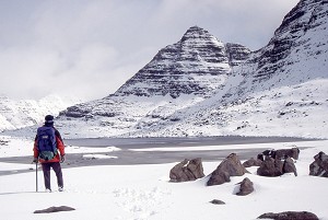
With summer just around the corner and daylight stretching out into evening this is prime season for plotting your next big adventure. Day walks are great of course, but now is your perfect opportunity to knock off something greater still, a multi-day backpacking journey. Britain is blessed with an extensive and diverse network of long distance trails; but which to go for? At the risk of inviting controversy we'll go out on a limb and suggest that these are the pick of the bunch:

The daddy of all Britain's big walks, the Pennine Way was the first long distance trail to be officially designated - way back in 1965 - and it remains the one to aspire to. Following northern England's high spine from Edale in the Dark Peak to Kirk Yetholm on the Scottish side of the Cheviots, this 400km+ upland odyssey takes many suitors the best part of three weeks to complete. Along the way are many challenging miles of forbidding Pennine moorland; but it's not all grim up north, and each stage of the trail has its own magic, from high summits and scenic dales to quintessential stone-built villages and cosy real ale pubs. Key landmarks include Kinder Scout, the Peak District's nearly-mountain; Pen-y-ghent, Yorkshire's really-mountain; the stunning limestone crag of Malham Cove; the waterfalls of High Force and Cauldron Snout; the vast glacial cirque of High Cup; glowering Cross Fell, the highest point both of the Pennine Way and of England outside the Lake District; some of the best of Hadrian's Wall; and the wild windy finish along the border ridge and over The Cheviot.

Based on the line of the improbable earthwork built in the 8th Century to defend King Offa's Mercia from kingdoms in what we'd now call Wales, this classic 285km route is a comprehensive journey through the English-Welsh border country, crossing said border more than 20 times on its wiggly course between Chepstow on the Severn Estuary and Prestatyn on the North Wales coast. Along the way you'll march through the best of the Marches: the Wye Valley (why? because it's gorgeous); the dramatic eastern escarpment of the Black Mountains; the under-appreciated Shropshire hills and the high moorland of the Clywdian Range.
Officially unveiled in 1980 the West Highland Way is Scotland's original national tail, and still arguably the best. Over the last three decades it has become a symbol of the Scottish outdoors, attracting visitors from all corners of the world. Linking the country's largest city with its highest peak, as the popular cliche has it, this 150km+ trail winds winds through a rich variety of landscapes – pastoral lowland, wood and loch shore, moor and mountain. Along the way it visits Scotland's first National Park, runs beside its best-loved loch, strides out over a corner of its wildest moor and crosses the mouth of its most atmospheric glen. You'll score no prizes for originality with this one, and you're never far (at least by highland standards) from civilisation and a dry bed; nevertheless the West Highland Way is worth a few days of anyone's time.

We've broken the WHW into manageable stages in these UKH Route Cards:

Dreamed up by Alfred Wainwright, this upland journey across the hilly grain of England may not enjoy the funding status that recognition as an official National Trail would bestow, but a vocal campaign is underway to rectify that - and they certainly have a point. In the four decades since its inception the 300km-odd C2C has gained ultra-classic status. You can't argue with three very different National Parks: a west-to-east cross section of the entire Lake District; a Swaledale-shaped slice though the northern edge of the Yorkshire Dales; and a finish through the wide open spaces of the North York Moors to the North Sea at Robin Hood's Bay.

One day a single footpath will loop the entire seaward edge of England; until then you'll have to settle for the best of it - and that's enough to be getting on with. Linking Somerset's Minehead with Poole Harbour in Dorset the long way round - that's a cool 1000km of coastline - this is by a huge margin England's longest long distance trail, and arguably one of the finest seaside walks anywhere in the world. It's a lot more hilly than you might expect, too. With scores of idyllic sandy coves, pounding surf, wooded coombes, historic fishing villages and endless dramatic clifftops, you've the makings of a very full summer holiday (or three) here, best fuelled with cream teas, cider and fish n' chips. Pack your cozzie and hope the weather plays ball.

Connecting Ulverston in the south of the county with Carlisle up near the Scottish border via 112km of classic Lakeland countryside, the Cumbria Way can be knocked off in a not-too-taxing five days. Taking in dales, passes and lake shores the route follows a low-level line of least resistance through the fells - though of course any number of summits could be visited in detours along the way. Highlights include Coniston Water, Tarn Hows, Langdale, the historic through-route of Stake Pass at the hub of the Lakeland fells, the wild valley of Langstrath, Borrowdale and the wooded shore of Derwentwater, and the rolling emptiness of the northern fells behind Skiddaw.

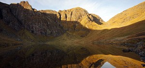
It's fair to say we've saved the best for last - at least if you like your walking spiced with a heady hit of wilderness. More an idea than an actual trail in the conventional sense, this 300km-odd backpacking quest takes you from Fort William to the northwest tip of the British mainland via an interweaving collection of possible routes, which thread their way gradually north through our wildest country. Even staying low in the passes and glens this is serious stuff, with resupply points spaced several days apart and only occasional fleeting contact with roads and habitation. Challenge and self reliance are the watchwords here, and wet feet are inevitable. Pack a tent and a bit of grit, then take your pick of all the sweet spots in the northwest: knobbly Knoydart; the sweeping ridges of Kintail; isolated Monar and Mullardoch; the improbable peaks of Coulin and Torridon; Fisherfield's well named 'great wilderness'; otherworldly Coigach, Assynt and the far-flung far north. A couple of weeks out in all of that is liable to change a person.
For essential tips on getting the best out of this grand adventure see How to Walk the Cape Wrath Trail
Hard to believe it's Halloween again. Why not give the trick or treating and tooth decay a miss this year and creep yourself out up a hill at midnight instead? Here are some suitably spooky spots...
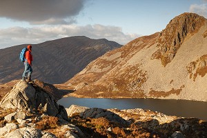

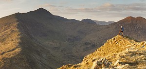
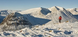
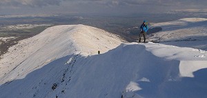
The high point of a hill doesn't always provide its most photogenic moments, but it does tend to be the place you stop for longest to take in your surroundings. Picking out a single favourite may be an impossible task, but that hasn't stopped us asking a number of...


Comments