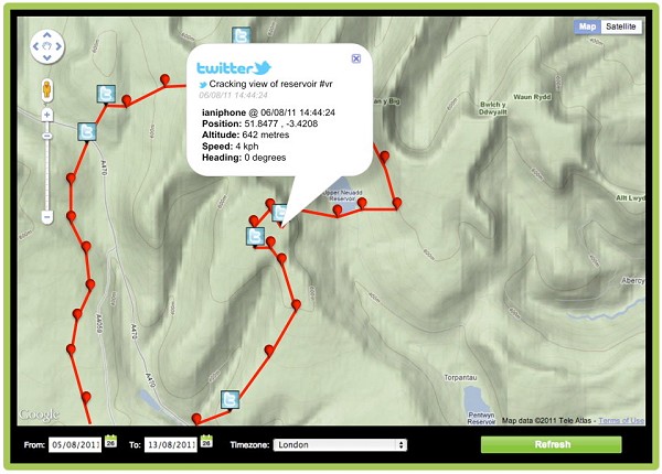
Mapping and outdoors GPS app ViewRanger last week launched a new enhancement to its BuddyBeacon location sharing feature by adding integration with Twitter messages. This new feature means that as well as using ViewRanger on their mobile to share their real-time location with others, customers can also attach Twitter messages and pictures by simply associating their Twitter account and then tweeting. As well as being a bit of fun it's easy to imagine serious users like mountain rescue teams finding this useful.
BuddyBeacon has proven popular as it allows real-time location sharing between mobiles and to the web. It means that if groups get separated whilst out walking (or whatever) they can use the ViewRanger app to see where others are and to navigate to them. The web access to BuddyBeacon means that non-users can also view the location of friends from home.
BuddyBeacon has become a hit with charity adventurers, who use it to share their event progress live with sponsors and supporters. It is also frequently used by the many Search & Rescue teams who have adopted ViewRanger to assist in their work as it helps team coordination both in training and during rescue operations. Each ViewRanger user protects their BuddyBeacon location using a PIN which they can choose to share with people that they want to allow to see their location.
With the new feature enhancement any Twitter message sent from an attached account can be appended to the corresponding time stamped BuddyBeacon location, when viewed via the web portal.
Announcing the new feature ViewRanger CEO Craig Wareham said:
'BuddyBeacon is a popular aspect of our app and one which takes it beyond the capabilities of dedicated GPS devices. With this new Twitter integration, people can now share their outdoor trip experiences with text and photo's as well as sharing their location.'
The App runs on a wide range of smartphones and devices that use the Apple iOS (iPhone/iPad), Android, or Symbian OS and works virtually anywhere in the world using web based mapping, which can be cached for off-line use. Additionally, it can upgraded to run premium topographic map data (like Ordnance Survey maps, say) for a growing number of countries including Belgium (if you must), Czech Republic, Finland, France, Germany, Holland (now we're really getting silly), Ireland, parts of Italy, Norway, New Zealand, Slovenia, Sweden, Switzerland & USA. A testament to the App's accuracy and reliability is the fact that it is today used by almost 50% of Search & Rescue teams in England & Wales.


Comments