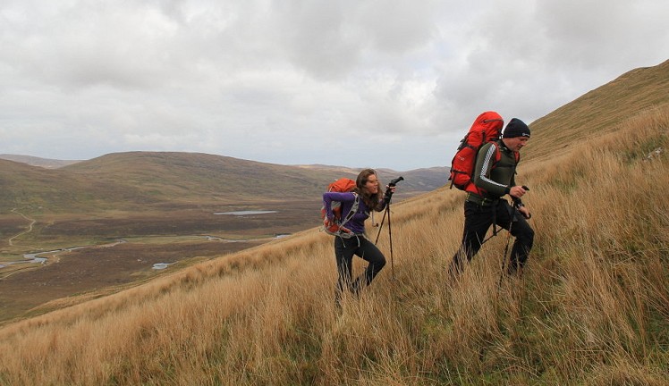
The northernmost mountains on the British mainland - and they really feel like it - this Corbett pair rises in windswept isolation between the bleak expanse of Strath Dionard and brooding Loch Eriboll. The sense of space is palpable here, with the open Atlantic to the north and the empty expanses of Sutherland all around. By local standards this is a short and manageable circuit, but though both hills look grassy-dull from the road, up close there’s plenty of rough ground, and some corners of unexpected craggy grandeur.
Fetching Map
Height Profile
metres / Distance
miles
Detailed description
1
NC3325459216 From Carbreck take the farm track towards Rhigolter farm. The track descends gradually to cross a bridge over the River Dionard, then continues to reach the farm buildings after nearly 2km. Go through a gate to pass left of the big barn, then just before the private house and outbuildings veer left off the track to pass through another gate onto open hillside.
2
NC3396257685 Even here on the standard Corbett bagging route (trodden in both ascent and descent) there is only a faint sign of a path – an indication of what to expect from the rest of the day. Head straight uphill beside a small burn, then continue to a gate in the top right corner of a fence. Now make a long rising traverse right up a long tedious reed-choked slope to emerge onto more shallow-angled ground in the mouth of Calbhach Coire, the broad peaty scoop between Cranstackie and Beinn Spionnaidh. Skirt around the left side of the corrie floor to minimise the bog slogging, then at the back of the corrie follow an obvious burn very steeply uphill (NB: not the deep gully on the left wall of the corrie). This leads to the bealach between the two mountains.
3
NC3565356251 Turn right, climbing a steep grassy prow above the corrie crags to reach a short level section of ridge. The final slopes of Cranstackie now rear up ahead, giving a strenuous ascent on jumbled boulders. Go roughly south-southwest across the boulder field on the summit plateau to the cairn on top, which stands on the edge of the mountain’s craggy western flank. Stunning view of the slate-grey Foinaven range from here.
4
NC3505855589 Return to the central bealach, then go roughly north-northeast on a long, steady plod up a pathless grassy slope. As the angle begins to ease you reach the boulder slopes; these give hard going up to the rock-strewn plateau top of Beinn Spionnaidh. Don’t be fooled by a deceptive little cairn that marks the top of Beinn Spionnaidh’s northwest spur (more on that in a bit) – the true summit is several hundred metres further northeast across the plateau, marked with a trig point in a ring of huge stones. It's hard to decide which of the two hills has a better outlook; this one's got the sea views.
5
NC3620457298 Go back across the plateau to the misleading cairn of stage 4. Here cut hard right to descend quite steeply onto the broad northwest spur, where the ground soon turns from stony to grassy. Climb the minor summit of Cioch Mhor. From here a direct descent of the ridge soon becomes unpleasantly steep, so aim roughly south-southwest towards the mouth of Calbhach Coire, then over the reedy lower slopes to rejoin the farm track at Rhigolter.
This has been viewed 5,985 times
Download
OS maps and some other mapping apps don't allow waypointsStatistics
Difficulty: ModerateDistance: 7.71 miles (12.40 km)
Total ascent: 1,076m
Steepest Gradient: 45% (1 in 2)
Time: 5 hours (Walking)
Voting:
from 2 votes
Login as Existing User
to rate this walk.
to rate this walk.
Additional Information
Start/Finish:Track turnoff at Carbreck – there's limited parking by the house and more just down the track, NC332592
Nearest town:
Durness
Terrain:
Beyond the access track it's reasonably hard going all the way, bogs and rough grass on the lower slopes and rocky ground up high, with steep climbs and only intermittent paths.
Seasonal variations:
Some of the steeper sections are likely to prove interesting in winter conditions, particularly the Calbhach Coire headwall and the summit slopes of Cranstackie.
Weather and Hill Conditions: mwis: Northwest Highlands – Met Office: West Highlands
Public transport:
Bus no.804 from Durness to Rhiconich – ask to get out at Carbreck www.travelinescotland.com
Guidebooks:
The Corbetts & Other Scottish Hills (SMC)
Maps:
OS Explorer 446 (1:25,000), OS Landranger 9 (1:50,000) Directory Listings:
Find more Listings near this route Tourist info:
Durness (0845 22 55 121)
Further Routes
by Dan Bailey UKH
- East Ridge of Beinn a' Chaorainn and Beinn Teallach 21 Jan
- A' Chralaig and Mullach Fraoch-choire 4 Dec, 2023
- Meall na Teanga & Sron a' Choire Ghairbh - The Loch Lochy Munros 6 Nov, 2023
- Bynack More 19 Oct, 2023
- Beinn a' Mhuinidh 4 Oct, 2023


