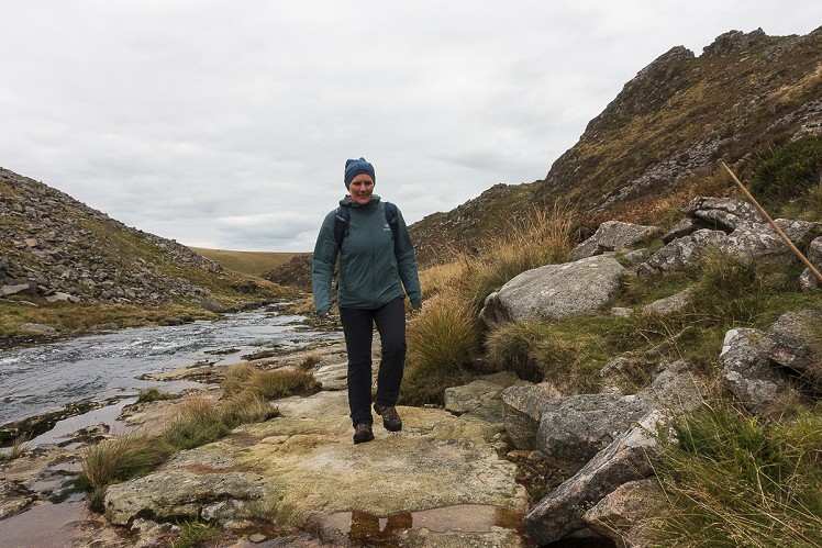
A classic route exploring one of the more rugged parts of Dartmoor, this short round packs in a lot of variety, and plenty of rough ground. First follow Tavy Cleave up into the wild heart of the moor. A twisting gorge choked with boulders, and featuring a cascading river and steep little granite peaks, the cleave feels surprisingly remote and impressive. Both branches of the upper valley host extensive archaeological remains, including the prehistoric village of Watern Oke, where over 70 hut circles have been identified. The climate must have been more hospitable back in the day. Return via Hare Tor, a nice craggy summit with far-reaching views. Note: this route is on the army's Willsworthy Range. Live firing takes place at scheduled times, and when that's going on the area is closed to public access on pain of possible accidental death. If you spot any ordnance lying around, don't investigate! For info visit access.mod.uk or call 0800 458 4868
Detailed description
This has been viewed 2,764 times
Download
OS maps and some other mapping apps don't allow waypointsStatistics
Difficulty: ModerateDistance: 4.42 miles (7.12 km)
Total ascent: 238m
Time: 2:30 – 3:30 hours (Walking)
to rate this walk.
Additional Information
Start/Finish:Car park at Lanehead, at the end of the public road from Mary Tavy onto the moor, SX536824
Nearest town:
Tavistock
Terrain:
The ground in Tavy Cleave alternates between boggy and rocky. The many boulders scattering the valley make for slow going, and the less able bodied will find progress a challenge. Up on Hare Tor, boulders are replaced by tussocks, while the featureless moorland needs careful navigation if it's cloudy. Overall, this walk is harder than the modest distance and ascent stats might suggest, and that's why I've graded it Moderate rather than Easy.
Public transport:
Bus to Mary Tavy, but the start of the route is a long walk from there!
Seasonal variations:
The main concern is to plan your visit around the firing times on the Willsworthy Range. For info visit access.mod.uk or call 0800 458 4868
Maps:
OS Explorer OL28 (1:25,000), OS Landranger 191 (1:50,000), OS Landranger 201 (1:50,000) Directory Listings:
Find more Listings near this route Tourist info:
Tavistock (01822 612 938); Dartmoor (01822 890 414); Okehampton (01837 53020)
Further Routes
by Dan Bailey UKH
- East Ridge of Beinn a' Chaorainn and Beinn Teallach 21 Jan
- A' Chralaig and Mullach Fraoch-choire 4 Dec, 2023
- Meall na Teanga & Sron a' Choire Ghairbh - The Loch Lochy Munros 6 Nov, 2023
- Bynack More 19 Oct, 2023
- Beinn a' Mhuinidh 4 Oct, 2023


