

UKHillwalking has teamed up with Mountain Training to bring you a series of articles on the topics covered in their Hill & Mountain Skills scheme.
The scheme is ideal for people who want to get started in hill or mountain walking, and the courses are run throughout the year all over the UK. The articles are all written by Mountain Training course providers about a particular area of the Hill & Mountain Skills syllabus, to give you a better idea of what the courses are all about.
Here guidebook author and Mountain Leader Mark Reid offers a basic introduction to the humble paper map, the single most effective tool you can carry on the hill.
There are 137,000 miles of Rights of Way in England and Wales, not to mention over three million acres of Open Access Land; mountain, moor, heath, downland and common land where you can walk freely away from paths and tracks. Then there's Scotland, which is pretty much open from top to bottom. There's a lifetime of exploration just waiting on your doorstep. The hills are your route to freedom - to savour fantastic views, reach hidden waterfalls, explore ancient remains, stride out across the summits, or just spend quality time with friends and family out in the fresh air surrounded by beautiful landscapes.

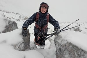
© Dan Bailey
"Taking time to understand a map and how it relates to the landscape will open up a whole new world - it is your passport to freedom"
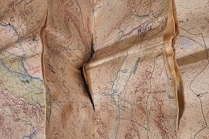
But people often say to me that they lack confidence to explore further, worried about getting 'lost' and unsure about where they can legally walk. So they stick to paths they know, and the more popular routes. This is where a map comes in - and I am talking paper maps that you can unfold, crease, write on and use to plan. Taking time to understand a map and how it relates to the landscape will help you overcome these barriers and open up a whole new world. It is your passport to freedom.

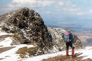
© Dan Bailey
What is a map?
Well there are maps for many different purposes of course, but the ones I am interested in here are the amazingly detailed landscape maps of the British Isles produced by the two market leaders Ordnance Survey and Harvey. These maps are two-dimensional representations of the landscape, produced to a specific scale, usually 1:25k, 1:40k or 1:50k. An important point to note is that the map is just a scale plan of the landscape, but it is not the landscape. Just like when you go out to a restaurant for a meal, the menu is not your dinner!
I am often asked about GPS units as a quick and easy answer to navigation. Indeed most mobile phones now have integrated GPS and mapping. You simply press a button and it tells you where you are. Yes a GPS can be a useful navigation tool, but you still need a map and appropriate skills. I don't have a GPS and I rely solely on traditional methods, as in my opinion a map and compass are better. A GPS spoon-feeds you information, which you then assume to be true. Learning map and compass skills allows you to design your own spoon and feed yourself! How often have you programmed your Sat Nav in your car and then, after driving for a while, realised that you actually do not know where you are and are being told where to turn?
"A GPS spoon-feeds you information, which you then assume to be true. Learning map and compass skills allows you to design your own spoon and feed yourself!"
The fundamentals of good navigation are always knowing where you are, where you want to go next and how to get there safely. It is about being engaged with the environment around you, and relating that to the map, and vice versa. Unlike the small screen on your phone or GPS, you can unfold a map to reveal not only your chosen route in its entirety but ALL potential routes, not to mention the surrounding landscape.

© Ordnance Survey

© Ordnance Survey
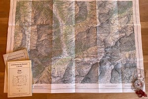
Using your map
Ordnance Survey maps are works of art, amazingly detailed, intricate and accurate. So accurate in fact that a small gully on the side of a remote hillside in the Cairngorms or on Kinder Scout will show up as small 'v' shapes on the contour lines on your map.
Maps show you many things: where you can legally walk (eg Rights of Way and Access Land), visible features on the ground (from walls and fences to buildings and pubs), the landform (contours) and natural features (water, woodland, vegetation and rock outcrops). Symbols are used to easily identify certain features. It is worth taking time to learn these symbols.

© Ordnance Survey
The map can also help you work out which way to walk. The vertical blue grid lines on the map are aligned to north (known as Grid North), so all you have to do is match these vertical grid lines with the north needle on your compass (Magnetic North) and then the map and landscape more or less correlate.
It is worth noting here that there are in fact three different 'norths':
Grid North - the lines on the map, all running parallel to the UK grid's central meridian
True North - the direction of lines of longitude, which all converge at the poles
Magnetic north - the one the compass needle points to. Thanks to fluctuations in the planet's magnetic field this slowly moves around, it's not fixed.
The difference in angle between true north and magnetic north is known as declination, while the difference between grid north and magnetic north is grid magnetic angle. These differences vary over time, and depending on your location. Differences between the three norths are given on OS maps. However in the UK at present the divergence is so small that it can be sensibly ignored for most basic hillwalking navigation.
Distances and timings can also be fairly accurately worked out, just using the map. Each grid square is 1km, irrespective of scale. And it takes on average 15 minutes to walk 1km on the flat. For walking in a straight line on the flat the maths is easy. For more wiggly routes, measuring on the map and then scaling up will give you a figure for distance. Add inclines, rough terrain or even a headwind and timings become harder to estimate - but that's a subject for another article.
So, you can use your map to plan a safe and enjoyable route through the terrain, taking account of slopes, hazards to avoid, features along the way and possible escape routes. It can also give you an accurate total distance and a good idea of timings too.

© hmcooke, Mar 2014
Navigation Strategies
Once you understand maps then you then need to apply this understanding to the landscape, to move from one point to another. This is where navigation skills come in, where you logically break down the information on the map into a strategy that includes direction (which way is it), distance (how far is it), detail (what am I going to pass) and destination (how will I know I have got there) - this strategy is known as the four Ds.
In addition to map and navigation skills, you also need to be get to grips with weather, clothing and gear, terrain plus much more. It is an art form as much as a set of skills.
Luckily, I believe, our brains are hard-wired to function in the natural environment; after all, as a species we have spent almost our entire time on this planet in the natural environment, fully engaged with the various ecosystems and the passage of the seasons. Research shows we have an innate connection with the natural world - just think about how a beautiful sunrise makes you feel.
Recently the Nobel Prize for physiology and medicine was awarded to scientists who discovered the brain's inner 'mapping' system. They discovered 'place' cells within the brain that form a mental map of where we are, and also 'grid' cells that help the brain judge distance and navigate. I believe that map reading and navigation skills simply build on our prehistoric survival instincts, how we found our way to food and back to shelter. This may explain why it feels so satisfying when you navigate successfully across the hills, and why it feels so daunting if you get misplaced!
So next time you are outdoors on a walk, map in hand, take a moment to think about how such an amazingly detailed map was created. And reflect that by using it you are simply tapping into hard-wired prehistoric brain functions. Our brains and bodies are designed to navigate our way across the hills; so hillwalkers are only doing what comes naturally.
For more Hill & Mountain Skills see the rest of the series:
About Mark Reid
Mark has spent the last 18 years walking the paths and tracks of the North of England, and has clocked up over 14,000 miles of footpaths since 1997, whilst researching and writing 17 books including The Inn Way series. He has also taken out over 4,500 people walking in the Yorkshire Dales, Lake District and beyond since 2007, and has gained various walking awards, including Mountain Leader. Each year his company Team Walking teaches hundreds of people how to read maps and navigate, and frequently sees people have 'eureka' moments on the hillside when they realise the potential of maps.
Mark is currently featured on ITV Yorkshire's 'A Breath of Fresh Air' TV walks series, with weatherman Jon Mitchell.
For more information about Mark Reid's outdoor courses visit the Team Walking website

About Mountain Training
Mountain Training's aim is to educate and train people in walking, climbing and mountaineering. The Hill & Mountain Skills scheme has been designed for beginner and novice hill walkers so that they can be confident about planning and safely enjoying their own walks. There are providers the length and breadth of the country who deliver these courses on behalf of Mountain Training and they run throughout the year. Find a course near you.
Mountain Training also administers a range of nationally-recognised mountain leadership, instruction and coaching awards, such as the Lowland Leader, Mountain Leader and Climbing Wall Award.
For more info visit their website


Comments