
They're small (400-499m) but with a whopping 447 of them the Pedwars are a tall order indeed. The people behind this brand new Welsh hill list tell us more.
Towards the middle of January this year I was enjoying a good winter walk over some hills in mid Wales. The snow conditions were excellent, just enough to enjoy and not so much as to hinder. With me on the walk was Mark Trengove, a good hill walking friend who happens to be the web host of Europeaklist, a website that specialises in the listing of European hills and mountains.

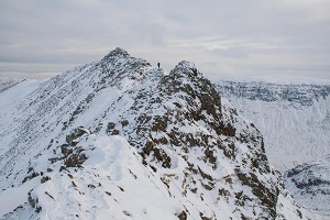
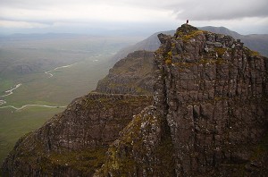
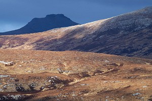
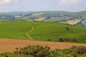
© Simon Caldwell, Nov 2010
After visiting No match for crag id:"Brondre-fawr Hill" (SO041782) we continued towards No match for crag id:"Castle Bank" (SO072776) and No match for crag id:"Moel Dod" (SO079767), two outliers on the opposite side of the valley. Conversation flowed as we discussed all manner of topics. One subject that kept cropping up was the possibility of producing a Europeaklist booklet about the hills that we were then heading towards. As these two hills are 476m and 467m in height, this booklet would be a listing for all the hills in Wales between the heights of 400m-499m. I already knew how good many of these hills are, as I'd visited over 250 of them.
'There are many hill areas where land at 400m or above comprises wild, little frequented moorland that is mountainous in nature. For Wales this is the Land of the Pedwars'
The thought of producing an accurate and definitive listing to these hills filled me with enthusiasm. Over the coming weeks I corresponded with Mark as plans were discussed and put in place. We soon had a third member of the team; Aled Williams, who I'd been working with for a number of years on Welsh upland place-name research.
With me compiling the list, Aled assessing each name for appropriate use and composition and Mark as editor guiding us through the pitfalls of list compilation we set about our task.

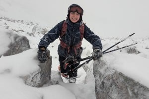
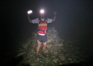
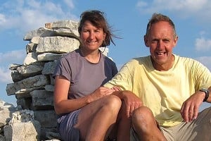
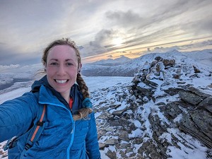
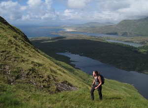
© Myrddyn Phillips
Myrddyn Phillips: List compiler
The qualification used to separate one hill from another was a minimum of 30m drop; also referred to as re-ascent or prominence. This is the vertical height gain from bwlch (the col) to summit. The choice of 30m was easy to make as it is standard in many British listings. The uplands in Britain south of the Scottish border do not only include hills with a height of over 500 metres; there are many hill areas where land at 400m or above comprises wild, little frequented moorland that is mountainous in nature. For Wales this is the 'Land of the Pedwars'. This listing can be viewed as an extension to the current listings of Welsh Hewitts (2000ft+ hills) and Welsh Deweys (500m hills).
'Part of the joy of compiling the list was dealing with so many hills in so many different areas of Wales, and the process of listing these hills gave me a greater understanding of the landscape'
I devised the name of 'The Pedwars' for the list, as pedwar is the Welsh word for 'four'. I thought this was rather apt for a listing to the Welsh 400m hills. I then set about scrutinising every Ordnance Survey 1:25,000 map as well as every Harvey map for the whole of Wales. As on-line mapping is now so easily available, the list's compilation was done using both paper and on-line versions. The benefits of on-line mapping are considerable, with old maps that sometimes give more accurate levelled heights now being available. The accuracy of the list was also enhanced from the surveys conducted for absolute height by G&J Surveys (an amateur team that's been re-surveying ambiguous hill heights - see UKH news here for instance). As a member of this surveying team, which also comprises John Barnard and Graham Jackson, I knew that the differential GPS equipment that we take height readings with is the best of its kind.
Over the coming months the list took shape as I worked from North to South Wales, listing each grouping of hills in an east-west direction. Each hill was grouped under a 'parent hill', which Mark dubbed as 'Cardinal Hills'; these being the highest hills connecting each group of 'Pedwar' hills. I realised during this period that part of the joy of compiling the list was dealing with so many hills in so many different areas of Wales, and the process of listing these hills gave me a greater understanding of the landscape in which they are situated.
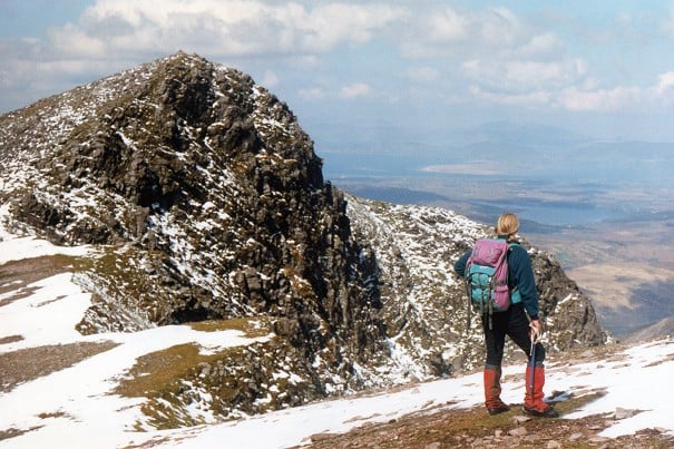
Many of these hills can be excellent walks on their own or combined with their higher neighbours, from the rugged Carreg y Saeth (crag of the arrow) (SH643302) in the northern Rhinogydd hills, to the sublime beauty of conically shaped Castell (the castle) (SH559493) in the Moel Hebog group. All the major hill ranges in Wales are represented in the Pedwars, from the peaks of Eryri down through the wild and remote central belt of the Cambrian Mountains to the old red sandstone ridges of the Brecon Beacons.
One aspect of the Pedwars' listing that is unique is the degree of place-name research that has been conducted for each and every name. As each hill region was finished the list was sent to Aled, and as the whole list comprises 447 Pedwars with another 268 sub-listed hills he had a staggering 715 hill-names to assess for appropriate use and composition.

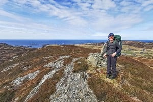
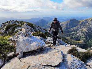
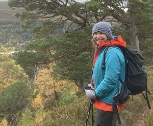
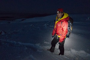
© Myrddyn Phillips
Aled Williams: Hill name research
Over the last couple of years Myrddyn and I have been working on a project to record and document upland place names in Wales. This research is both current and historical in nature, and we have spoken to over 600 people who have an intimate knowledge of the Welsh uplands, including landowners, farmers, shepherds, gamekeepers and local historians. We aim to eventually publish this research, which is currently work in progress.
'A name brings character to a hill and often reflects the appearance, position or the history associated with it, and we hope that users of the Pedwars will enjoy and make use of the names listed within'
The role that I played in the production of the Pedwars involved assessing hill names for merit and composition. Each one of 715 hills that appear in the list has been meticulously cross-referenced between successive OS maps and local information. Some of the hills were unnamed on OS maps, such as Garnfor (SH360457), the northern peak of Yr Eifl, whilst others had a number of possible names to choose from - such as the twin peaks of No match for crag id:"Foel Uchaf" (SN806622) and No match for crag id:"Foel Isaf" (SN803614) in the Elenydd. In each case, time and thought was invested into the appropriate naming of a hill and I worked within the limits of the information that was available to me. Any names involving a degree of uncertainty in geographical placement were not used and such hills were listed using the 'Point (Height)' notation, which is considered standard practice in European peak-listing.
Unique to this list are hill names that, to our knowledge, have never been recorded on any document or map. It's a comforting thought that these names are now preserved for future generations to enjoy and analyse. A name brings character to a hill and often reflects the appearance, position or the history associated with it, and we hope that users of the Pedwars will enjoy and make use of the names listed within.
During this whole process Myrddyn and I were corresponding with our editor, Mark, who ultimately shaped the appearance of how the booklet now looks.

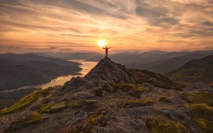
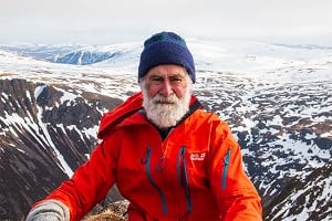
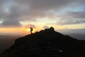
© Myrddyn Phillips
Mark Trengove: Publisher and editor
Although the Europeaklist website has been in existence for over five years I only occasionally publish listings to hills in Britain. As the name of the website suggests; my speciality is listings of European mountains. These can be as diverse as hills in Estonia, Lithuania, Belgium and even The Netherlands, to the higher mountains of Austria, France and Germany. However, I have published listings to the British Isles, including the 'Majors', these being the 600m prominence hills of Britain and Ireland, as well as a complimentary series of booklets to the 'High Hills of the Irish Republic' and the 'High Hills of Wales'.
'The Europeaklist philosophy is to produce quality listings that are free of charge to access and download. I also hope to produce a Welsh language version of the Pedwars booklet'
I'm always interested in Europeaklist producing further listings to the hills of Britain - and especially for Wales, a country I call my home and the hills of which I know and love, for on them my first hill-walks took place. The Europeaklist philosophy is to produce quality listings that are free of charge to access and download. It is also my hope in the not too distant future to produce a Welsh language version of the Pedwars booklet.
Just before the work was completed we all met beside Cow Green Reservoir in the Pennines, - rather an unusual meeting spot, considering we'd been working on Welsh 400m hills for a number of months. However, as Aled is now living in the north of England, it proved a convenient spot to meet. The day proved particularly wet and quite windy. As part of the reason for meeting was to produce a video that could accompany the booklet, we sought shelter in a run-down barn where, to the amusement of all involved, we attempted to produce a film documenting the story behind the Pedwars.
We've included a Notes section towards the end of the Pedwars booklet where there are 210 separate comments that can be cross referenced against the respective hill within the list. Many of these notes refer to the height and drop of the hill. Some of this information came from old maps where levelled heights will be more accurate than present day map heights produced by photogrammetry. Other information relates to drop values ascertained from basic levelling surveys conducted by Myrddyn as well as those of increased accuracy conducted by G&J Surveys. Aled's research is also represented in the Notes section, with references to research sources and comments on alternative names.
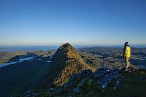
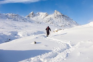
Interspersed throughout the Pedwars booklet are photographs of some of the hills listed. As Europeaklist self-publishes we can update the Pedwars booklet with additional information when needed. When a second edition of the booklet is published, we hope to have a more diversified and better selection of photographs of Pedwar hills to choose from. The booklet can be downloaded free of charge and is available as a print-booklet and an e-booklet.
Work through your Pedwars and you'll get to know some of the most beautiful uplands in Wales.
The Pedwars booklet is available from Europeaklist here. It can be downloaded free of charge and is available as a print booklet and an e-booklet.
Myrddyn, Mark and Aled explain more about their work on a Youtube interview here.
About the Authors

Myrddyn Phillips
Myrddyn has over 20 years of hill walking experience from scaling North Africa's highest mountain to trekking in Nepal. He's completed the Welsh 3000ft challenge in under 24 hours and has completed 16 rounds of the Welsh 2000ft mountains, including an ascent of each mountain in each month of the year; still the only known Monthly Calendar Round of Hills ever achieved in the mountains of the British Isles. He has surveyed over 420 hills in Wales, using a basic levelling technique, and is a member of the G&J Surveys team who use differential GPS surveying equipment to determine absolute height and drop of hills, such as the recent elevation of Thack Moor in the Pennines to the dizzying heights of 2000ft mountain status. Myrddyn has a joy for Welsh upland place-name research and is an honorary life member of the Snowdonia Society.

Aled Williams
Aled is a research scientist by profession and has a PhD in physical chemistry, specialising in photovoltaics and organic electronics. He has over 10 years of hill walking experience and has completed a round of the Welsh 2000ft mountains. He is also interested in natural history and enjoys studying the arctic-alpine flora of the Welsh mountains. As a native Welsh speaker (though now relocated to northern England) Aled is devoted to Welsh upland place name research and is currently in the process of writing a book on the subject, along with Pedwars author Myrddyn Phillips. It's a mammoth undertaking.

Mark Trengove
Mark is a civil servant specialising in tax. Born near London, he has made Wales his home for the last fifteen years. He began hill-walking quite late in life (aged 39), and has now been heading for the hills for the last sixteen years. Apart from his beloved Wales, he heads when he can to the Scottish Highlands, Southern Uplands, Lake District and Pennines. A member of the Marilyn Hall of Fame, Mark is also the first known person to complete the Welsh Hewitts, Sub-Hewitts, Marilyns and Sub-Marilyns on the same day. To date Mark has only climbed 69 Pedwars, but aims to increase that total now the list has been published on his site Europeaklist. Apart from hillwalking and listing, Mark is a keen genealogist and enthusiast for music of the Baroque and Classical Periods.


Comments